Cape Stolbchaty
Russia /
Sahalin /
Yuzhno-Kurilsk /
World
/ Russia
/ Sahalin
/ Yuzhno-Kurilsk
, 20 km from center (Южно-Курильск)
World / Japan / Hokkaido
cape (geography), UNESCO World Heritage Site
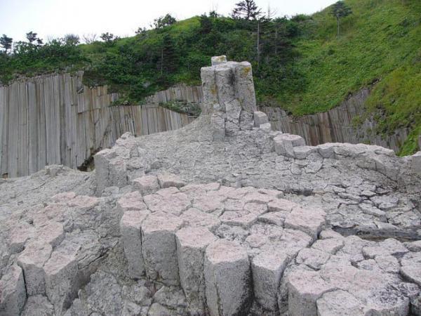
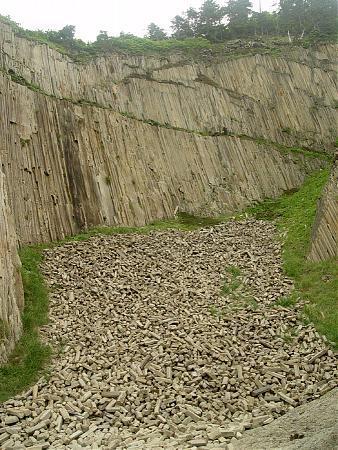
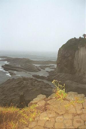
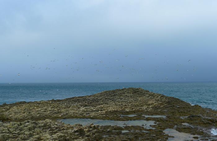
Strange formations of stone were found. Traditional geologists think that it might be lava structures, but locals who live nearby, and many visitors who come here from different parts of Russia doubt this and call them man made, probably belonging to some unknown people who lived here in prehistoric times. Some new-agers even suppose that this structures were used by some technologically advanced civilization that existed on the Earth at the age before the Bible flood.
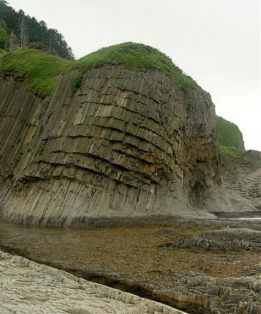
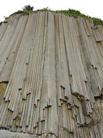
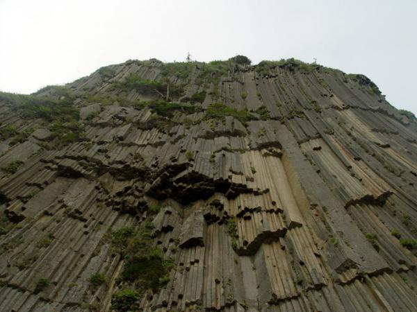
No question about it: those are basalt columns, and one of the most impressive examples ever. They form when you get an upwelling of basaltic lava underground that doesn’t break the surface. Since the molten rock is insulated and has a long slow time to cool, it crystallizes into these long multi-sided columns. When the ground above the formation wears away, the columns are revealed
No question about it: those are basalt columns, and one of the most impressive examples ever. They form when you get an upwelling of basaltic lava underground that doesn’t break the surface. Since the molten rock is insulated and has a long slow time to cool, it crystallizes into these long multi-sided columns. When the ground above the formation wears away, the columns are revealed
Wikipedia article: http://en.wikipedia.org/wiki/Cape_Stolbchaty
Nearby cities:
Coordinates: 44°1'25"N 145°40'46"E
- Mys Tevi 2026 km
- Mys Rebro 2158 km
- Mys Glinyanyy 2159 km
- Mys Kayagyt'kanan 2184 km
- Cape Wrangell 2193 km
- Mys Ivrivin 2201 km
- Mys Vodopadnyy 2273 km
- Mys Obryvistyy 2337 km
- Mys Etauchyyu 2377 km
- Mys Astronomicheskiy 2378 km
- Ecological trail 1.4 km
- Mendeleyevo Airport 6.9 km
- Mechnikov mt. 7.8 km
- Kunashirsky Strait 18 km
- Kurilski National Park 21 km
- Kunashir Island 25 km