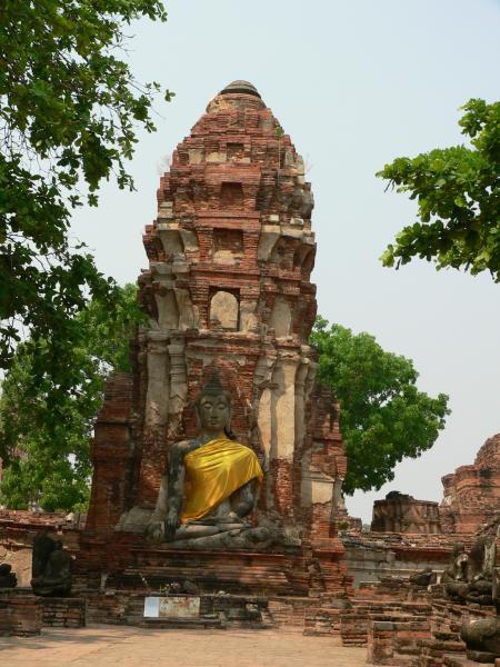
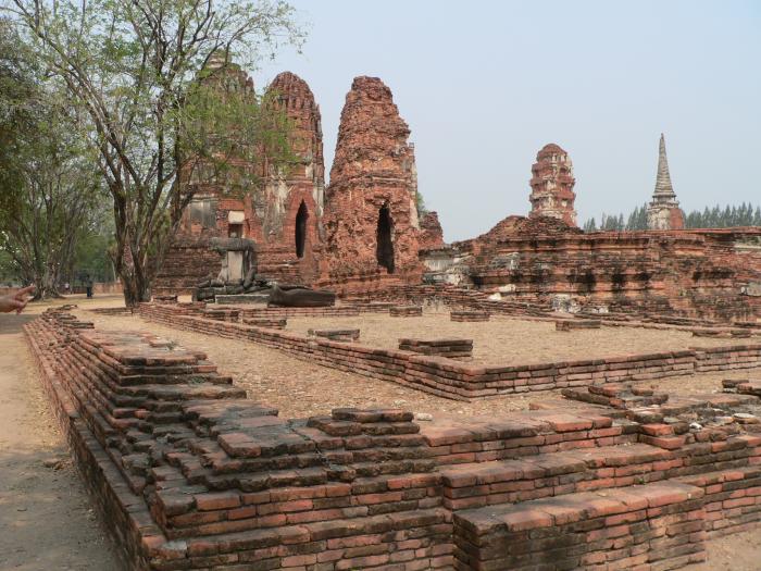
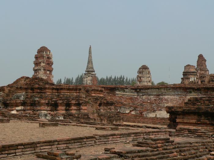
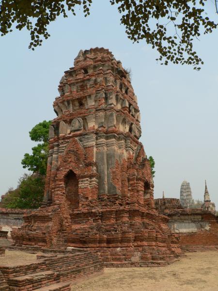
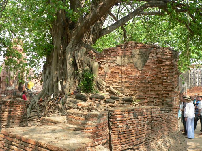
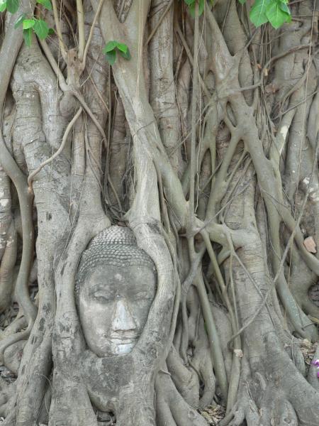
แผนผังภาพถ่ายทางอากาศวัดมหาธาตุ อยุธยา (เทศบาลนครพระนครศรีอยุธยา)
| ruins, buddhist temple, tourist attraction
Thailand /
Phra Nakhon Si Ayutthaya /
Ayutthaya /
เทศบาลนครพระนครศรีอยุธยา
World
/ Thailand
/ Phra Nakhon Si Ayutthaya
/ Ayutthaya
โลก / ประเทศไทย / จังหวัดพระนครศรีอยุธยา / Ayutthaya
ruins, buddhist temple, tourist attraction

Nearby cities:
Coordinates: 14°21'25"N 100°34'2"E
- วัดพุทไธศวรรย์ 2.2 km
- วัดใหญ่ชัยมงคล 2.8 km
- วัดปัญญานันทาราม 30 km
- ลานธรรมรอบมหาธรรมกายเจดีย์ ที่วัดพระธรรมกาย 31 km
- มหาวิหารพระมงคลเทพมุนี สด จันทสโร 33 km
- วัดแสงธรรมฯ 36 km
- วัดพระวิสุทธิวงศ์ (ลำไทร) 54 km
- วัดองครักษ์ธรรมปัญญาราม 54 km
- วัดเขาคอก 62 km
- วัดบางหอย 77 km
- ต.ประตูชัย อ.พระนครศรีอยุธยา 1.1 km
- อ.พระนครศรีอยุธยา จ.พระนครศรีอยุธยา 1.6 km
- เทศบาลเมืองอโยธยา 3.6 km
- อบต.สวนพริก อ.พระนครศรีอยุธยา 3.8 km
- ต.หันตรา อ.พระนครศรีอยุธยา 4 km
- ต.บ้านเกาะ อ.พระนครศรีอยุธยา 4.1 km
- อบต.บ้านป้อม อ.พระนครศรีอยุธยา 4.9 km
- อบต.ธนู อ.อุทัย 6.2 km
- อบต.ข้าวเม่า อ.อุทัย 7.9 km
- เทศบาลตำบลบางปะหัน 11 km
Comments