Wat Mahathat Central Prang (Phra Nakhon Si Ayutthaya City Municipality)
| ruins, buddhist temple, tourist attraction
Thailand /
Phra Nakhon Si Ayutthaya /
Ayutthaya /
Phra Nakhon Si Ayutthaya City Municipality
World
/ Thailand
/ Phra Nakhon Si Ayutthaya
/ Ayutthaya
World / Thailand / Phra Nakhon Si Ayutthaya / Phra Nakhon Si Ayutthaya
ruins, buddhist temple, tourist attraction
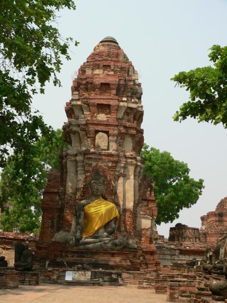
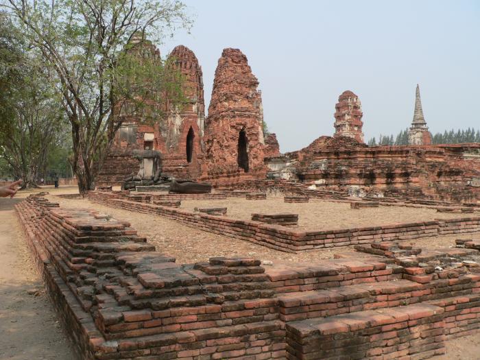
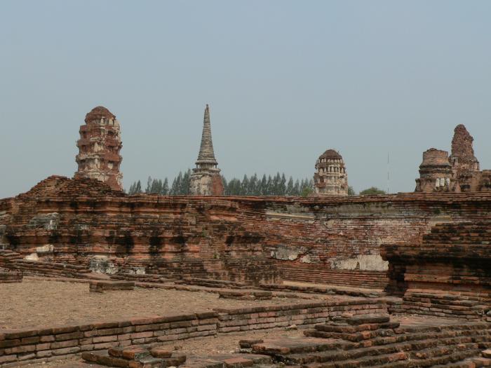

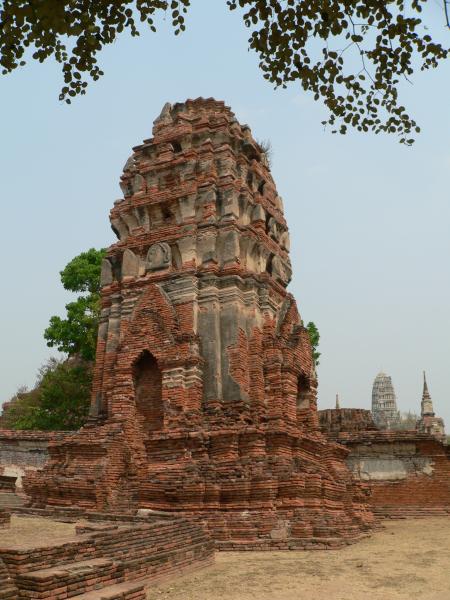
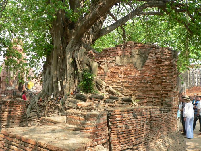
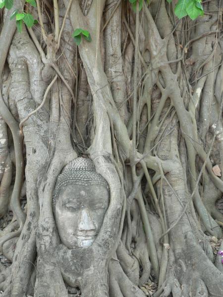
Wat Mahathat was started in 1374 A. D. during the reign of King Borommarachathirat I and finished during the reign of King Ramesuan (1388-1395). The main prang collapsed during the reign of King Songtham (1610-1628). The restoration of this prang was probably completed during the reign of King Prasatthong (1630-1655) and the height of the prang was increased at the same time.
The main prang collapsed again around 1911 and looters used the opportunity to dig for treasure. In 1956, the Thailand Fine Arts Department excavated the central area of the prang and recovered relics of the Buddha within a seven-layer reliquary.
The main prang collapsed again around 1911 and looters used the opportunity to dig for treasure. In 1956, the Thailand Fine Arts Department excavated the central area of the prang and recovered relics of the Buddha within a seven-layer reliquary.
Nearby cities:
Coordinates: 14°21'25"N 100°34'2"E
- Wat Phutthaisawan 2.2 km
- Wat Phra Chao Phya-Thai or Wat Yai Chai-mongkol 2.8 km
- Wat U Taphao 30 km
- Wat Panyanantharam 30 km
- Dhammakaya Cetiya 31 km
- Wat Phraphuttha Saengtham 36 km
- Wat Pra Wisutthiwong 54 km
- Wat Ongkharak Tham Panyaram 54 km
- Khao Khok Temple 62 km
- Wat Bang Hoi 77 km
- Pratu Chai Subdistrict 1.1 km
- Phra Nakhon Si Ayutthaya District 1.6 km
- Ayothaya Town Municipality 3.6 km
- Suan Phrik SAO Area 3.8 km
- Hantra Subdistrict 4 km
- Ban Ko Subdistrict 4.1 km
- Ban Pom SAO Area 4.9 km
- Thanu SAO Area 6.2 km
- Khao Mao SAO Area 7.9 km
- Bang Pahan Municipal Area 11 km