Saguaro National Park West
USA /
Arizona /
Picture Rocks /
World
/ USA
/ Arizona
/ Picture Rocks
World / United States / Arizona
park, national park

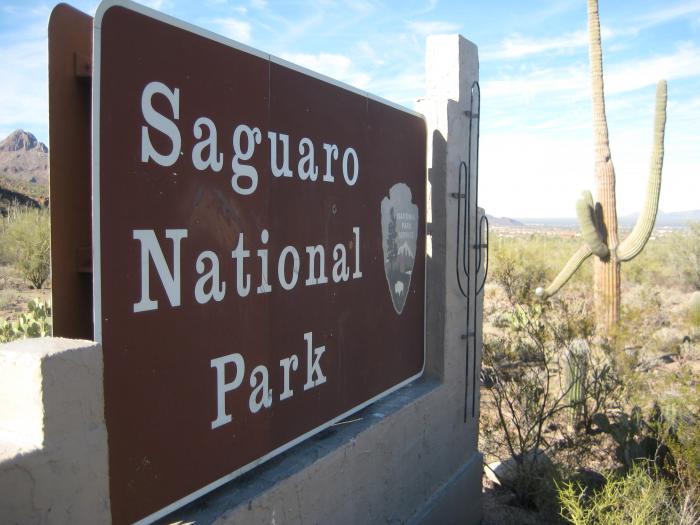


Tucson Mountain District. www.nps.gov/sagu/
www.nps.gov/hfc/carto/PDF/SAGUmap2.pdf
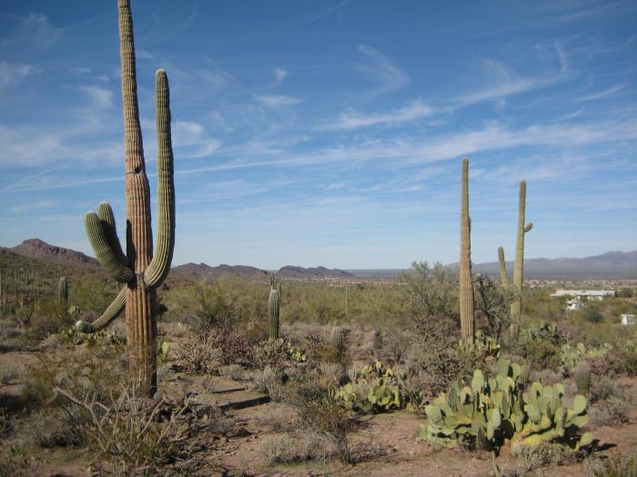
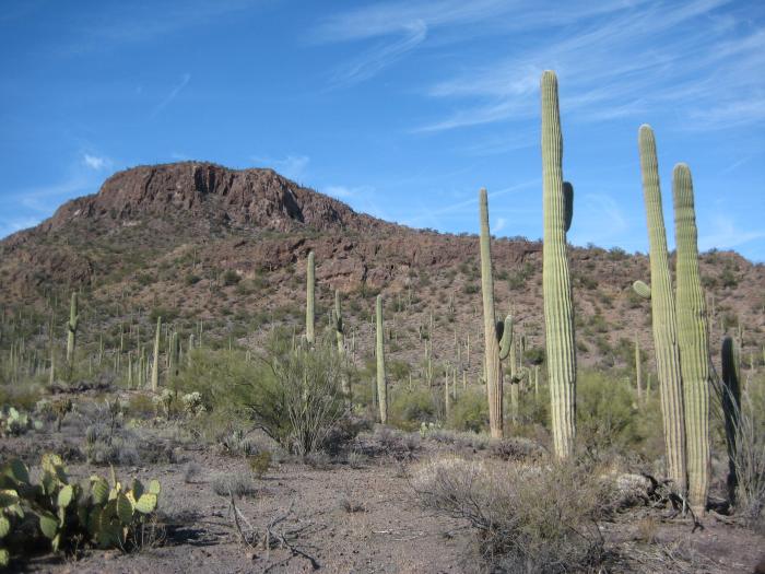
The Park takes its name from the Saguaro Cactus some of the longest living Cactus on the planet.
en.wikipedia.org/wiki/Saguaro
www.nps.gov/hfc/carto/PDF/SAGUmap2.pdf
The Park takes its name from the Saguaro Cactus some of the longest living Cactus on the planet.
en.wikipedia.org/wiki/Saguaro
Wikipedia article: http://en.wikipedia.org/wiki/Saguaro_National_Park
Nearby cities:
Coordinates: 32°18'0"N 111°10'47"W
- Picture Rocks District Park 5.7 km
- Arizona-Sonora Desert Museum 6 km
- Crossroads at Silverbell District Park 10 km
- Los Morteros Conservation Area 11 km
- Vahalla Regional Park 21 km
- Coyote Mountain Wilderness 47 km
- Picacho Peak State Park 53 km
- Copper Basin 100 km
- Jim Korsten West Pinal County Park 107 km
- Sonoran Desert National Monument 163 km
- Arizona Portland Cement Co. Rock Quarry 6.5 km
- Ironwood Reserve 8.2 km
- Quarry Pines Golf Club 10 km
- Picture Rocks Solar Field 10 km
- Cemex 10 km
- Saguaro Springs 10 km
- BKW Farms 10 km
- Sunflower 10 km
- Majo Farms, Inc. 12 km
- Ironwood Forest National Monument 36 km