Bulkeley Bridge (Hartford, Connecticut)
USA /
Connecticut /
Hartford /
Hartford, Connecticut
World
/ USA
/ Connecticut
/ Hartford
World / United States / Connecticut
Neoclassical (architecture), NRHP - National Register of Historic Places, bridge, road bridge, arch bridge
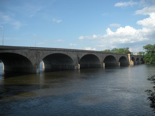

Carries I-84, U.S. Route 44, and U.S. Route 6 over the Connecticut River. It is one of the oldest bridges still in use by the Interstate highway system. Originally, a covered bridge spanned the width of the river at this point. The Irish slums were located on the western side of the river, at the end of the bridge.
- Built: 1908
- Designer: Edward D. Graves
- Type: masonry arch
- Length: 1,192 feet
- Carries: Interstate 84
- Crosses: Connecticut River
- Still in use: yes
- Also known as: Hartford Bridge
- Date added to NRHP: 12/10/1993
NRHP #93001347
- Built: 1908
- Designer: Edward D. Graves
- Type: masonry arch
- Length: 1,192 feet
- Carries: Interstate 84
- Crosses: Connecticut River
- Still in use: yes
- Also known as: Hartford Bridge
- Date added to NRHP: 12/10/1993
NRHP #93001347
Wikipedia article: http://en.wikipedia.org/wiki/Bulkeley_Bridge
Nearby cities:
Coordinates: 41°46'10"N 72°39'56"W
- Arrigoni Bridge 22 km
- Norwottuck Rail Trail 67 km
- Jamestown Verrazzano Bridge 107 km
- Newport (Claiborne Pell) Bridge 112 km
- Mt. Hope Bridge 118 km
- Charles Braga Bridge 124 km
- Lowell Connector 145 km
- causeway 149 km
- Maurice J. Tobin Memorial Bridge 150 km
- Long Island Viaduct (Long Bridge / Long Island Bridge) (Closed) 151 km
- Asylum Hill 2.4 km
- Barry Square 3.1 km
- South Meadows 3.3 km
- South End / Little Italy 4 km
- East Hartford, Connecticut 4 km
- Burnside 4.8 km
- Hartford County, Connecticut 5 km
- Hockanum 5.4 km
- Old Wethersfield Historic District 6.9 km
- Glastonbury, Connecticut 13 km