BGH Flyover (Baguio)
Philippines /
Cordillera /
Baguio
World
/ Philippines
/ Cordillera
/ Baguio
World / Philippines / Benguet / Baguio City
overpass / flyover
Add category
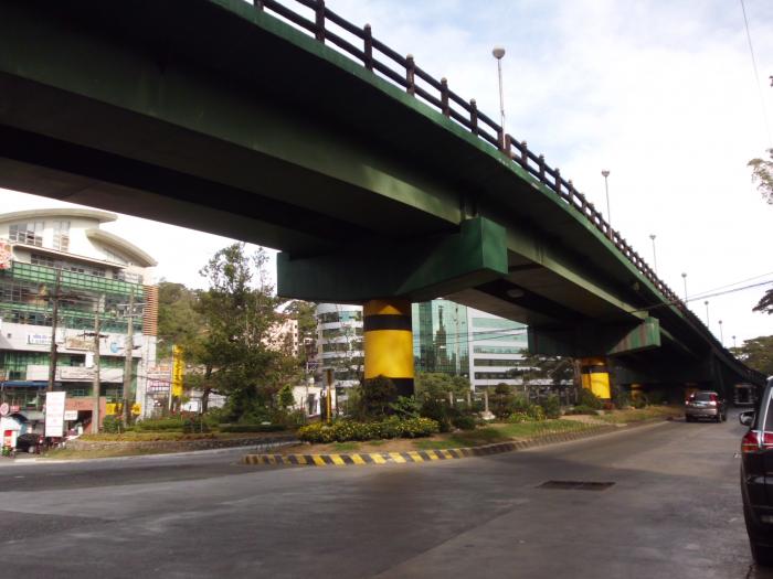
The BGH Flyover is the 172-meter long two-way flyover of the City of Baguio, located at the Baguio General Hospital Rotunda.
It is the second flyover constructed in the City of Baguio (the first was the Magsaysay Avenue Flyover), and was opened to the public on January 17, 2008.
It had become the center of controversy and quarrel among local politicians and various local citizens as some deemed its construction unnecessary considering that the traffic volume in the area has lessened.
See: www.yehey.com/news/Article.aspx?id=195933
Nearby cities:
Coordinates: 16°24'8"N 120°35'43"E
- Pantal Bridge 49 km
- Candaba Viaduct 162 km
- EDSA - Timog Avenue Flyover 203 km
- EDSA Ortigas Flyover 207 km
- Shaw Boulevard Flyover 208 km
- EDSA corner Shaw boulevard 208 km
- Estrella-EDSA Flyover 210 km
- C-5 / Pasig Boulevard Flyover 210 km
- Tramo Flyover 212 km
- Tagum City Flyover 1146 km
- BGH Compound (Barangay) 0.4 km
- Watershed 0.6 km
- Military Cut-off 0.6 km
- Burnham Park 0.6 km
- Richview Subdivision 1.3 km
- Woods Gate Subdivision 1.7 km
- Bengao 1.9 km
- Golf Course 1.9 km
- Eagle Crest Subdivision 2.3 km
- Camp John Hay 2.3 km
Comments