Finke (Aputula)
Australia /
Northern Territory /
Alice Springs /
World
/ Australia
/ Northern Territory
/ Alice Springs
World / Australia / Northern Territory
village
Add category

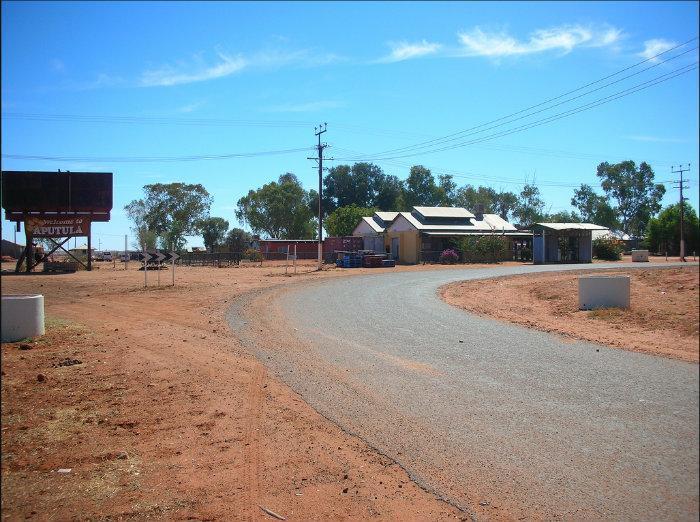
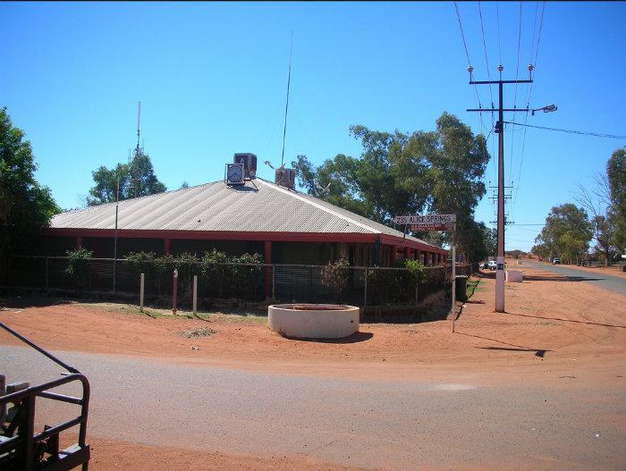
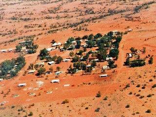
Finke, also known as Aputula is administered by the Aputula Aboriginal Land Trust. Facilities, goods and services available at Finke (Aputula) include: food, water, fuel, EFTPOS, medical services, postal services, some mechanical and tyre repairs, public phone, tourist information, toilets, showers, accommodation and camping facilities.
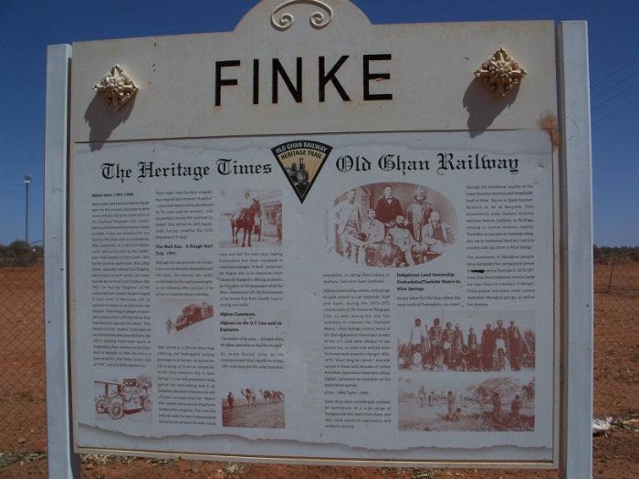
The township of Finke just north of the South Australian border in the Northern Territory was originally a railway town. The old Ghan railway crossed the Finke River just north of the township. Any major flood in the river washed out the rail bridge so the settlement developed primarily to repair the rail crossing.
In 1981 when the new railway was opened through Kulgera 150km to the West, the community was set up as a Uniting Church Mission for the local aborigines.
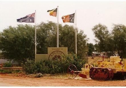
Aputula (25°35′S 134°34′E) is a remote Indigenous Australian community in the Northern Territory of Australia. It is south of Alice Springs, 159 km east of the Stuart Highway, near the South Australia and Northern Territory border.
The community is also known as Finke, which was the name Europeans gave to the railway siding from which the township eventually grew. Most of the Europeans left the town when the Central Australian Railway line was shifted westwards.
It was after this that the town came to be known as Aputula. The name comes from a place called 'Putula' near the community, which used to be the site of a water soakage. Putula is an Arrernte word. Arrernte people used to get their water there, before the white people and the railway line came to the area.
Aputula holds the record of having the hottest day ever recorded in the Northern Territory—48.3 °C (118.9 °F) on 1 and 2 January 1960.
The population of the town is 250 people. They are Pitjantjatjara, Yankunytjatjara, Luritja, and Lower Southern Arrernte people.
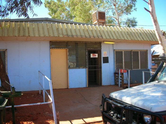
The health Centre is permanent and has 9 rooms, including men’s and women’s waiting and consulting rooms with toilet and shower, an emergency room, office, pharmacy and laundry.
The township of Finke just north of the South Australian border in the Northern Territory was originally a railway town. The old Ghan railway crossed the Finke River just north of the township. Any major flood in the river washed out the rail bridge so the settlement developed primarily to repair the rail crossing.
In 1981 when the new railway was opened through Kulgera 150km to the West, the community was set up as a Uniting Church Mission for the local aborigines.
Aputula (25°35′S 134°34′E) is a remote Indigenous Australian community in the Northern Territory of Australia. It is south of Alice Springs, 159 km east of the Stuart Highway, near the South Australia and Northern Territory border.
The community is also known as Finke, which was the name Europeans gave to the railway siding from which the township eventually grew. Most of the Europeans left the town when the Central Australian Railway line was shifted westwards.
It was after this that the town came to be known as Aputula. The name comes from a place called 'Putula' near the community, which used to be the site of a water soakage. Putula is an Arrernte word. Arrernte people used to get their water there, before the white people and the railway line came to the area.
Aputula holds the record of having the hottest day ever recorded in the Northern Territory—48.3 °C (118.9 °F) on 1 and 2 January 1960.
The population of the town is 250 people. They are Pitjantjatjara, Yankunytjatjara, Luritja, and Lower Southern Arrernte people.
The health Centre is permanent and has 9 rooms, including men’s and women’s waiting and consulting rooms with toilet and shower, an emergency room, office, pharmacy and laundry.
Wikipedia article: http://en.wikipedia.org/wiki/Aputula
Nearby cities:
Coordinates: 25°34'55"S 134°34'38"E
- Titjikala 114 km
- Hermannsburg 259 km
- Papunya 379 km
- Kaltukatjara 560 km
- Penong 722 km
- Munglingup 1604 km
- Bremer Bay 1760 km
- Borden 1834 km
- Marchagee 1887 km
- Eneabba, WA 1959 km
- Chambers Pillar 110 km
- Kulgera 131 km
- Junction of Stuart and Lasseter Highways 145 km
- Erldunda Station 145 km
- Seven Water Holes opal diggings. From 1930 restarted 1990 by John Civenek 164 km
- Henbury Meteorites Conservation Reserve 183 km
- Mygoora Lake 191 km
- Indulkana Community 199 km
- Kenmore Park , SA 229 km
- Mimili 244 km