Andover Earth Station
USA /
Maine /
Andover /
Roxbury Notch Road
World
/ USA
/ Maine
/ Andover
World / United States / Maine
telecommunication, satellite/space tracking station

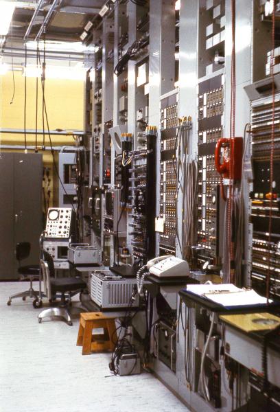

Land was purchased in January 1961, and construction of the complex began on May 1. Building construction was completed and the equipment was installed in February 1962. The Ground Station was operational in the Spring of 1962. AT&T and Bell Labs initiated, funded, constructed and took the leadership to make this project possible.
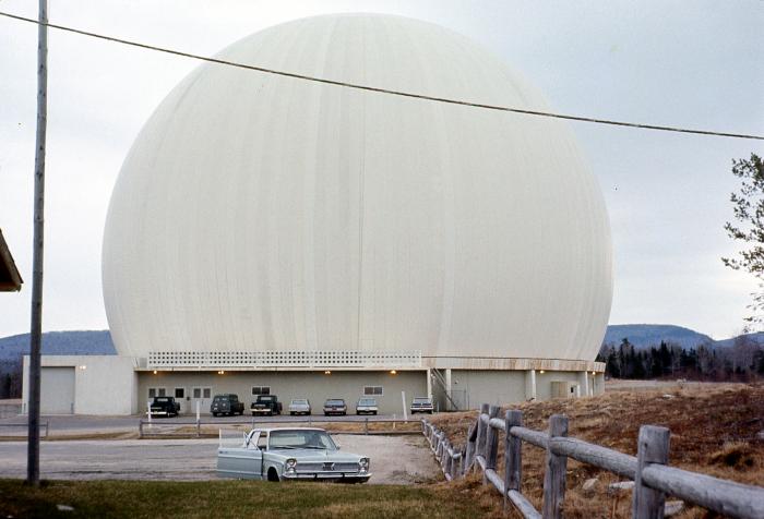
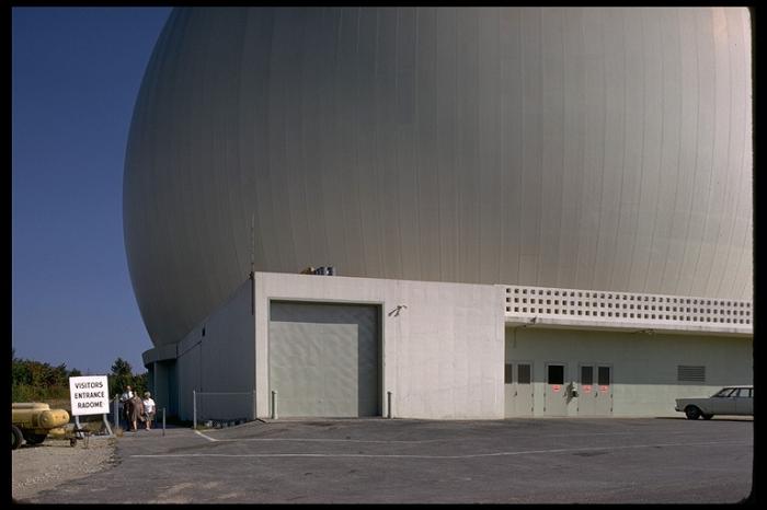
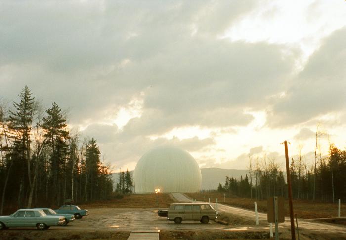
The Andover Earth Station was equipped with a giant horn antenna, 7 stories high and weighed 340 tons. To protect it from bad weather, a radome made of Dacron covered the antenna. It was 160 feet (49 m) high, 210 feet (64 m) wide and weighed 30 tons.
www.skyrocket.de/space/doc_sdat/intelsat-1.htm
The Andover Earth Station was equipped with a giant horn antenna, 7 stories high and weighed 340 tons. To protect it from bad weather, a radome made of Dacron covered the antenna. It was 160 feet (49 m) high, 210 feet (64 m) wide and weighed 30 tons.
www.skyrocket.de/space/doc_sdat/intelsat-1.htm
Wikipedia article: http://en.wikipedia.org/wiki/Andover_Earth_Station
Nearby cities:
Coordinates: 44°38'11"N 70°41'46"W
- Streaked Mountain Radio Site 48 km
- Manns Hill Radio Site 89 km
- Northeast Kingdom Online 106 km
- 160 Frog Hollow Lane 111 km
- Charter Communications 115 km
- Split Brook Cell Site 223 km
- KMEA Group 239 km
- Verizon Waltham 254 km
- Rehoboth Town Hall and Parks 309 km
- Superior Bulding (ESPN) 377 km
- West Central Franklin, Maine 20 km
- Weld, Maine 21 km
- Rangeley Plantation, Maine 28 km
- Sandy River, Maine 32 km
- Phillips, Maine 34 km
- Temple, Maine 34 km
- Avon, Maine 34 km
- Madrid, Maine 36 km
- Rangeley, Maine 38 km
- Dallas Plantation, Maine 41 km