Munisipyo ng Santo Tomas (Santo Tomas, La Union)
Philippines /
Ilocos /
Patac /
Santo Tomas, La Union
World
/ Philippines
/ Ilocos
/ Patac
Mundo / Pilipinas / /
Opisina, bahay pamahalaan, local government (en)
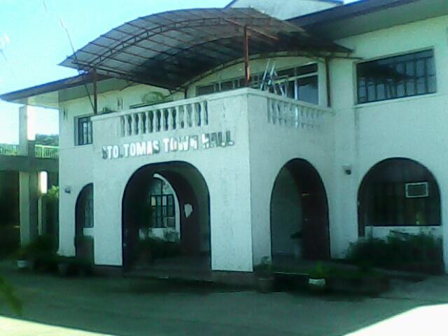
Munisipyo ng Santo Tomas is a Opisina, bahay pamahalaan, local government (en) located in Santo Tomas, La Union. Munisipyo ng Santo Tomas - Santo Tomas, La Union on the map.
Kalapit na mga lungsod:
Coordinates: 16°17'3"N 120°23'26"E
- Pamahalaang Panglungsod ng Lungsod ng Dagupan 27 km
- Pamahalaang Panlalawigan ng Zaragoza 102 km
- Munisipyo ng Jaen 119 km
- Pamahalaang Bayan ng Baliuag 157 km
- Bagong Pamahalaang Panglunsod ng Lungsod ng Malolos 165 km
- Pamahalaang Panlungsod ng Cavite 208 km
- Pamahalaang Panlalawigan ng Tanza 216 km
- Pamahalaang Panglungsod ng Lungsod ng Trece Martires 229 km
- Pamahalaang Panlalawigan ng Laurel 255 km
- Bagong Pamahalaang Panlalawigan ng Calaca 266 km
- basketballcourt_linong Sto.Tomas..Keno Geno edzel 0.9 km
- Laplana, Galano, Catungal, Valmonte and Escobar Compound 1.7 km
- Swiss 1.7 km
- Foronda Fishpond 2 km
- Fishpond 2.4 km
- Namonitan Sto.Tomas Lupa Gas Station 3.7 km
- Church Yan...Di Ko Lang Sure Anung Church Yan 4.5 km
- Gulpo ng Lingayen 21 km
- Lalawigan ng Pangasinan 29 km
- Lalawigan ng La Union 31 km