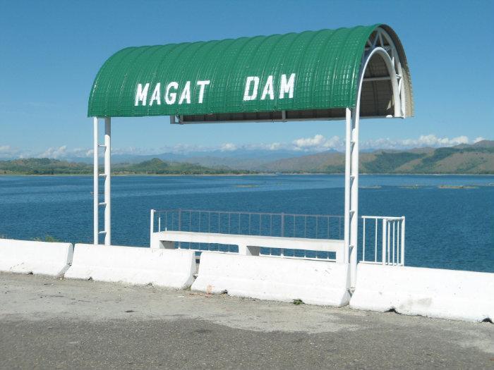
SN Aboitiz Power Inc. (Alfonso Lista)
Philippines /
Cagayan Valley /
Ramon /
Alfonso Lista
World
/ Philippines
/ Cagayan Valley
/ Ramon
World / Philippines / Isabela / Ramon
dam, hydroelectric power station/plant
The construction and appurtenant structures was authorized by P.D. 693 signed on May 7, 1975 by the late President Ferdinand E. Marcos. The Magat Dam was constructed in 1978 and inaugurated by the Late Pres. Ferdinand E. Marcos on October 27, 1982[2] and started operations in 1983. [3] Implementation of this multipurpose project was based on the preliminary study conducted in 1973 by the National Irrigation Administration (NIA) with the assistance of the United States Bureau of Reclamation (USBR) and the United States Agency for International Development (USAID).
Subsequent detailed and extensive damsite investigation and engineering studies further confirmed the feasibility of what is now known as NIA's most daring infrastructure project and one of Asia's biggest dams today.
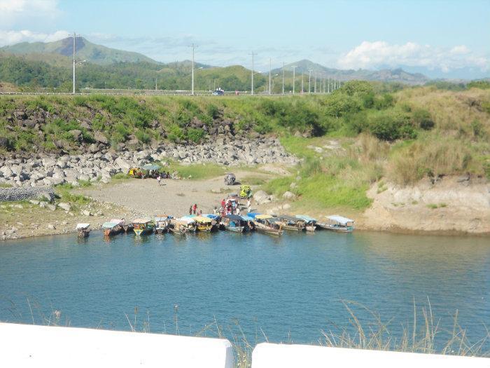
It was Southeast Asia's first largest multipurpose dam.[4] The dam is part of the Magat River Multipurpose Project (MRMP) which was financed by the World Bank and whose purpose is to improve on the existing Magat River Irrigation System (MARIS) and to triple the production of rice in the Cagayan River basin.[2]
LOCATION:
The Magat Dam is located six (6) kilometers of the Maris Diversion Dam. It is connected by an all weather road to San Mateo-Santiago Road at Oscariz, Ramon, Isabela some 350 kilometers north of Metro Manila.
SOURCE OF FUNDS:
The project was jointly financed by the Philippine Government and the World Bank which extended a 150M U.S Dollars loan to finance the foreign exchange requirement.
In addition, a 9M U.S. dollars loan from Bahrain was obtained for the purchase of other equipment for the diversion tunnels, soils laboratory and model testing.
Total project cost is 3.4B pesos(yr. 1975).
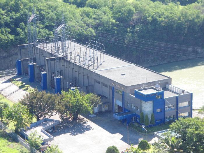
The irrigation facilities, including the reservoir, the intake gates to the hydroelectric plant, and the dam itself, is owned and managed by the National Irrigation Authority (NIA) while the hydroelectric plant itself was owned by the National Power Corporation (Napocor).[2] Under the Electric Power Industry Reforms Act of 2001 (Republic Act No. 9136), the Magat Dam hydroelectric plant underwent a privatization process. As a result, the plant's ownership and operation was turned over to SN Aboitiz Power Inc. (SNAP), a joint venture of a local company, Aboitiz Equity Venture (AEV), and the Norwegian SN Power Invest (SN Power) in April 2007.[2] SNAP won the privatization bidding in 2006.[5]
After the privatization of the hydroelectric plant, the provinces of Ifugao and Isabela had a dispute over the tax resulting from the transfer of the plant to SNAP. An agreement was made to divide the tax evenly, about 57 million pesos each, though some further disputes remain over the jurisdiction of various elements of the dam.
The dam was constructed to last for 50 years but increased siltation and sedimentation in the reservoir, slash-and-burn farming, illegal logging ang fish-caging resulted to the deterioration of the dam's watershed. The massive 1990 Luzon earthquake also contributed to the increased siltation in the Magat River system. Because of this, President Gloria Macapagal-Arroyo instructed various government agencies to create a rehabilitation plan to improve the lifespan of the dam system.
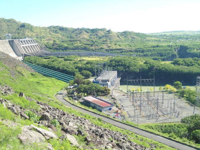
PROJECT FEATURES MAGAT HIGH DAM: SPILLWAY:
Height = 114 meters Length = 500 meters
Crest Length = 4,160 meters Width = 164 meters
Volume of Rocks & =18 million cu.m. Discharge Cap.= 30,600cu.m
Earth materials Radial Gates = 7 sets
Concrete = 1.00 million cu.m. Orifice Gates = 2 sets
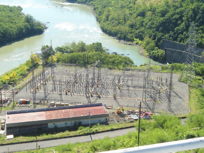
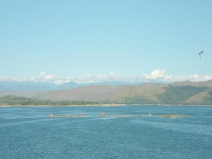
RESERVOIR: DIVERSION TUNNELS: Storage Cap.at Full Supply Level(FSL)=1.08 billion cu.m. Number= 2 Area at FSL = 45 sq. km. Diameters = 12m. Area at min. Supply Level = 15 sq. km. Ave.Length=630 m.
Elevation at FSL = El. 193.00 m.
Maximum Flood Level = El. 197.60 m.
Live Storage = 810 MCM
POWER HOUSE: Installed Capacity . . . . 360 MW
Additional Capacity . . . 180 MW
Total . . . . . . . . . . 540 MW
Subsequent detailed and extensive damsite investigation and engineering studies further confirmed the feasibility of what is now known as NIA's most daring infrastructure project and one of Asia's biggest dams today.
It was Southeast Asia's first largest multipurpose dam.[4] The dam is part of the Magat River Multipurpose Project (MRMP) which was financed by the World Bank and whose purpose is to improve on the existing Magat River Irrigation System (MARIS) and to triple the production of rice in the Cagayan River basin.[2]
LOCATION:
The Magat Dam is located six (6) kilometers of the Maris Diversion Dam. It is connected by an all weather road to San Mateo-Santiago Road at Oscariz, Ramon, Isabela some 350 kilometers north of Metro Manila.
SOURCE OF FUNDS:
The project was jointly financed by the Philippine Government and the World Bank which extended a 150M U.S Dollars loan to finance the foreign exchange requirement.
In addition, a 9M U.S. dollars loan from Bahrain was obtained for the purchase of other equipment for the diversion tunnels, soils laboratory and model testing.
Total project cost is 3.4B pesos(yr. 1975).
The irrigation facilities, including the reservoir, the intake gates to the hydroelectric plant, and the dam itself, is owned and managed by the National Irrigation Authority (NIA) while the hydroelectric plant itself was owned by the National Power Corporation (Napocor).[2] Under the Electric Power Industry Reforms Act of 2001 (Republic Act No. 9136), the Magat Dam hydroelectric plant underwent a privatization process. As a result, the plant's ownership and operation was turned over to SN Aboitiz Power Inc. (SNAP), a joint venture of a local company, Aboitiz Equity Venture (AEV), and the Norwegian SN Power Invest (SN Power) in April 2007.[2] SNAP won the privatization bidding in 2006.[5]
After the privatization of the hydroelectric plant, the provinces of Ifugao and Isabela had a dispute over the tax resulting from the transfer of the plant to SNAP. An agreement was made to divide the tax evenly, about 57 million pesos each, though some further disputes remain over the jurisdiction of various elements of the dam.
The dam was constructed to last for 50 years but increased siltation and sedimentation in the reservoir, slash-and-burn farming, illegal logging ang fish-caging resulted to the deterioration of the dam's watershed. The massive 1990 Luzon earthquake also contributed to the increased siltation in the Magat River system. Because of this, President Gloria Macapagal-Arroyo instructed various government agencies to create a rehabilitation plan to improve the lifespan of the dam system.
PROJECT FEATURES MAGAT HIGH DAM: SPILLWAY:
Height = 114 meters Length = 500 meters
Crest Length = 4,160 meters Width = 164 meters
Volume of Rocks & =18 million cu.m. Discharge Cap.= 30,600cu.m
Earth materials Radial Gates = 7 sets
Concrete = 1.00 million cu.m. Orifice Gates = 2 sets
RESERVOIR: DIVERSION TUNNELS: Storage Cap.at Full Supply Level(FSL)=1.08 billion cu.m. Number= 2 Area at FSL = 45 sq. km. Diameters = 12m. Area at min. Supply Level = 15 sq. km. Ave.Length=630 m.
Elevation at FSL = El. 193.00 m.
Maximum Flood Level = El. 197.60 m.
Live Storage = 810 MCM
POWER HOUSE: Installed Capacity . . . . 360 MW
Additional Capacity . . . 180 MW
Total . . . . . . . . . . 540 MW
Nearby cities:
Coordinates: 16°49'37"N 121°27'18"E
- Ambuklao Dam and Water Reservoir (Lake) 85 km
- Binga Hydroelectric Dam & Water Reservoir 91 km
- Canili-Diayo Dam 115 km
- Angat Reservoir and Hydroelectric Power Plant (Hilltop) 202 km
- Angat Lake 215 km
- La Mesa Dam and Reservoir 236 km
- Pilar Dam 838 km
- Liguasan Marsh 1149 km
- Babagon Dam 1341 km
- Sarawak Bakun Dam Site, Bakun HEP, 37 km from Belaga town 1762 km
- Isla Verde 3.4 km
- Magat Dam Reservoir 4 km
- IFSU Potia Campus 6.5 km
- Yongoyong 7.1 km
- Halag Small Mining Area 7.1 km
- halag proper 7.4 km
- Fumagkeng's Point 7.4 km
- Inchapnep Village 12 km
- Nepojnoc Village 13 km
- Pikkan (Sarap Maligo dito) 13 km