Magat Dam (Ramon)
Philippines /
Cagayan Valley /
Ramon
World
/ Philippines
/ Cagayan Valley
/ Ramon
World / Philippines / Isabela / Ramon
dam, hydroelectric power station/plant


Geography
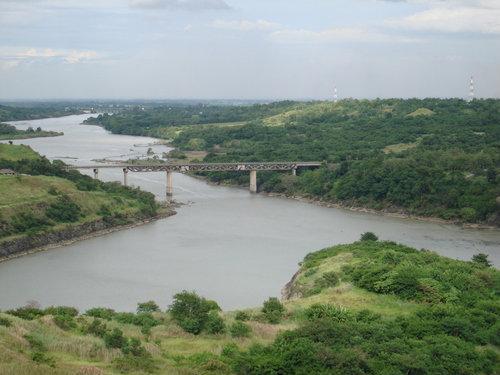
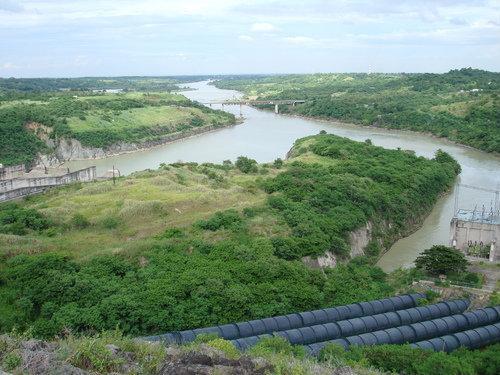
The Magat Dam is located on the Magat River at the boundary between the municipalities of Alfonso Lista in the province of Ifugao and Ramon in Isabela both on the island of Luzon. The Magat River is the largest tributary of the Cagayan River, the longest river in the country.
Magat River
The Magat Dam is located on the Magat River, which is the largest tributary of the Cagayan River on the island of Luzon.[1] Cagayan is the longest river in the Philippines.[1] The Magat River has an estimated yearly water discharge of 9,808 million cubic meters and has an approximate crest length of 4,160 meters with its headwaters in the province of Nueva Vizcaya and its confluence with the Cagayan River in the province of Isabela
The portion of the Magat River on which Magat Dam is located forms part of the boundary between the provinces of Ifugao and Isabela and this is the reason for the dispute between the local governments of the two provinces over the jurisdiction of Magat Dam.
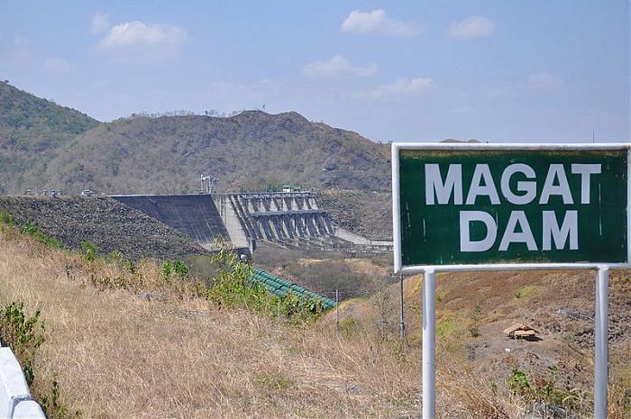
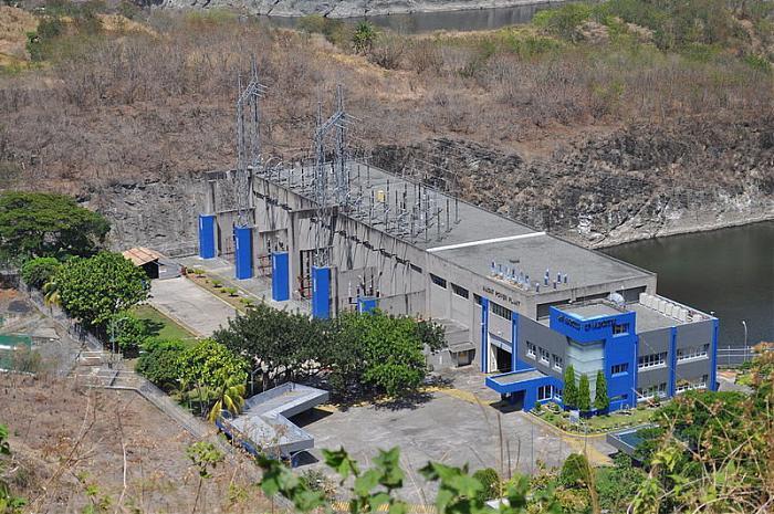
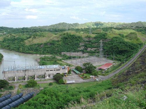
Magat Dam is a large rock-fill dam. Constructed in 1983, it is one of the largest dams in the Philippines and has two primary purposes, as a source of irrigation water and as a provider of hydroelectric power.
Locale Alfonso Lista, Ifugao / Ramon, Isabela
Construction began 1978
Opening date 1982
Dam and spillways
Type of dam Rock-fill dam
Height 114 m
Length 4,160 m
Impounds Magat River
Reservoir
Surface area 117 km²
Max. water depth 193 meters
Reservoir length 193 meters
Max. reservoir width 193 meters
Power station
Installed capacity 360 MW
The Magat Dam is located on the Magat River at the boundary between the municipalities of Alfonso Lista in the province of Ifugao and Ramon in Isabela both on the island of Luzon. The Magat River is the largest tributary of the Cagayan River, the longest river in the country.
Magat River
The Magat Dam is located on the Magat River, which is the largest tributary of the Cagayan River on the island of Luzon.[1] Cagayan is the longest river in the Philippines.[1] The Magat River has an estimated yearly water discharge of 9,808 million cubic meters and has an approximate crest length of 4,160 meters with its headwaters in the province of Nueva Vizcaya and its confluence with the Cagayan River in the province of Isabela
The portion of the Magat River on which Magat Dam is located forms part of the boundary between the provinces of Ifugao and Isabela and this is the reason for the dispute between the local governments of the two provinces over the jurisdiction of Magat Dam.
Magat Dam is a large rock-fill dam. Constructed in 1983, it is one of the largest dams in the Philippines and has two primary purposes, as a source of irrigation water and as a provider of hydroelectric power.
Locale Alfonso Lista, Ifugao / Ramon, Isabela
Construction began 1978
Opening date 1982
Dam and spillways
Type of dam Rock-fill dam
Height 114 m
Length 4,160 m
Impounds Magat River
Reservoir
Surface area 117 km²
Max. water depth 193 meters
Reservoir length 193 meters
Max. reservoir width 193 meters
Power station
Installed capacity 360 MW
Wikipedia article: http://en.wikipedia.org/wiki/Magat_Dam
Nearby cities:
Coordinates: 16°49'30"N 121°27'18"E
- Ambuklao Dam and Water Reservoir (Lake) 85 km
- Binga Hydroelectric Dam & Water Reservoir 91 km
- Canili-Diayo Dam 115 km
- Angat Reservoir and Hydroelectric Power Plant (Hilltop) 201 km
- Angat Lake 214 km
- La Mesa Dam and Reservoir 235 km
- Pilar Dam 837 km
- Liguasan Marsh 1148 km
- Babagon Dam 1341 km
- Sarawak Bakun Dam Site, Bakun HEP, 37 km from Belaga town 1762 km
- Isla Verde 3.3 km
- Magat Dam Reservoir 4 km
- IFSU Potia Campus 6.7 km
- Halag Small Mining Area 7.1 km
- Yongoyong 7.2 km
- halag proper 7.5 km
- Fumagkeng's Point 7.5 km
- Inchapnep Village 12 km
- Nepojnoc Village 13 km
- Pikkan (Sarap Maligo dito) 14 km