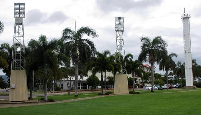
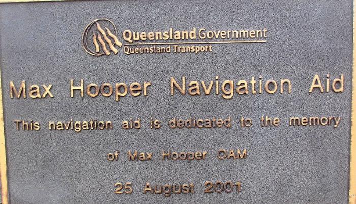
Max Hooper Navigation Aid Light (Townsville)
Australia /
Queensland /
Townsville
World
/ Australia
/ Queensland
/ Townsville
navigation beacon - marine
Add category
Nearby cities:
Coordinates: 19°15'32"S 146°49'27"E
- Island Point Light 341 km
- Breakwater 1740 km
- Fort West light Hume Tower light Murray Tower light Queenscliff Lower Lighthouse 2127 km
- Hobart Control Tower 2630 km
- Distrik Navigasi Kelas III Kendari 3134 km
- Naval Communication Station Harold E. Holt 3413 km
- Stoney Point Light 3501 km
- Ponte Zanguilles light 9975 km
- Richards Bay South Breakwater Light 11218 km
- Richards Bay North Breakwater Light 11219 km
- Port of Townsville - Bulk Sugar Terminal & Sheds 0.8 km
- BP Bulk Fuel Terminal 0.8 km
- Victoria Park 1 km
- Townsville Railway Yard 1.1 km
- Harbourside Coldstores 1.2 km
- Fertilizer Store 1.6 km
- Port of Townsville 1.6 km
- Townsville Recreational Boating Park 1.7 km
- Townsville Port Nickle Loader 2 km
- Cannington Lead and Zinc Facility 2 km