Servia High Bridge
Greece /
Kozani /
Servia /
World
/ Greece
/ Kozani
/ Servia
, 6 km from center (Σέρβια)
World / Greece / Dytiki Makedonia
road bridge, do not draw title


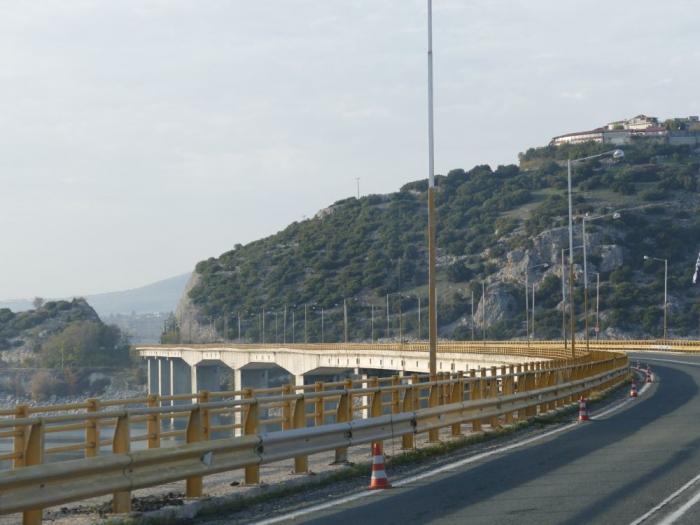
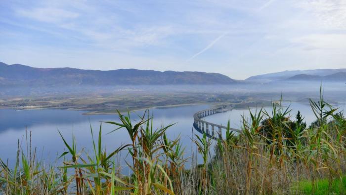

The Servia High Bridge (Greek: Υψηλή Γέφυρα Σερβίων, romanized: Ypsili Gefyra Servion) is one of the longest bridges in Greece, with a length of 1,372 m. Construction began in 1972 along with the Ypsili Gefyra Servion artificial lake and was completed in 1975.
Designed by Riccardo Morandi, was constructed from a joint venture Xekte SA–Skapaneus SA.
The bridge is a part of the GR-3/E65 (Athens - Lamia - Larissa - Kozani - Florina) and is located 15 km southeast of the city of Kozani and 5 km northwest of Servia. It is one of the two bridges of the lake; the other is the Rymnios Bridge to the southwest near Aiani and is smaller, with 615 m length.
Wikipedia article: http://en.wikipedia.org/wiki/Lake_Polyfytos_Bridge
Nearby cities:
Coordinates: 40°13'58"N 21°58'15"E
- Viaduct 18 km
- Grevenitis river bridge 47 km
- Venetikos Bridge (Left Branch) 58 km
- Venetikos Bridge (Right branch) 58 km
- Anilio Bridge 86 km
- Megalorrema bridge 89 km
- Arahthos bridge 103 km
- Kristallopigi bridge 154 km
- Rio-Antirrio Bridge 212 km
- Wadi el Kuf Bridge 839 km
- Huntite quarry 2.2 km
- Artificial Lake of Polyfyto (Haliacmon River) 3 km
- Servia-Velventos Μunicipality 10 km
- Kozani Municipality 10 km
- "Filippos" National Airport of Kozani 12 km
- Industrial area Kasla 15 km
- Άγιος Γεώργιος - Ηπειρώτικα 16 km
- Kamvounia Mts 21 km
- Peripheral unit of Kozani 31 km
- Peripheral unit of Imathia 41 km