USA /
New York /
Saddle Rock /
New York City, New York


Throggs Neck (New York City, New York)
World / USA / New York / Saddle Rock World / United States / New York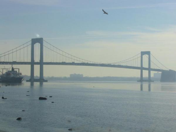
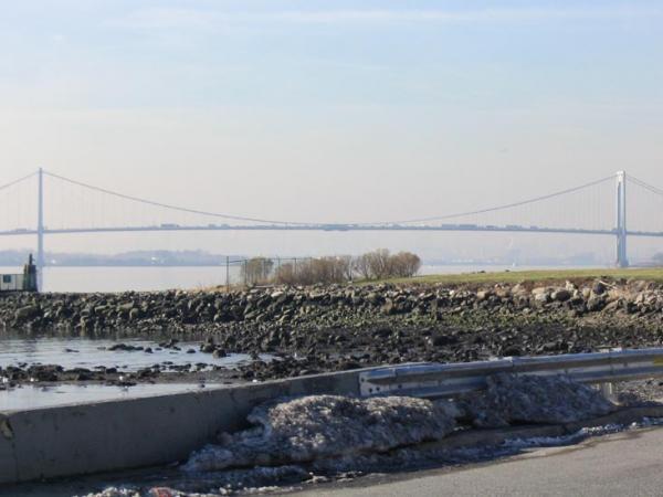
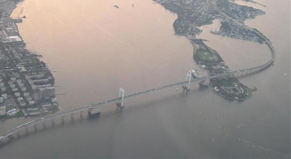
Throggs Neck (also known as Throgs Neck) is a narrow spit of land in the southeastern portion of the borough of the Bronx in New York City. It demarcates the passage between the East River (an estuary), and Long Island Sound. "Throggs Neck" is also the name of the neighborhood of the peninsula, bounded on the north by Waterbury and Layton Avenues, on the west by Westchester Creek, and on the east by the shores of Eastchester Bay, and to the south by the East River and the Long Island Sound respectively.
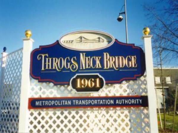
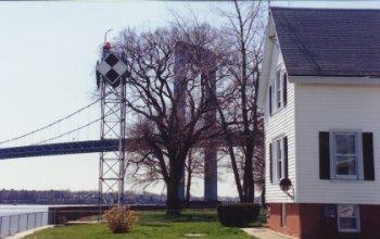
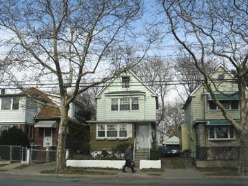
Within the greater boundaries of the Throgg's Neck neighborhood are the sub-neighborhoods of ; Edgewater Park, Locust Point, Silver Beach & Schuylerville. Throggs Neck was largely exempt from the severe urban decay that affected much of the Bronx in the 1970s.Throggs Neck is at the northern approach to the Throgs Neck Bridge, which connects the Bronx with the neighborhood of Bay Terrace in the borough of Queens on Long Island. The Throgs Neck Lighthouse formerly stood at its southern tip.
Historically, the correct spelling is with two "g's," and while NYC Parks Commissioner and Triborough Bridge and Tunnel Authority Chairman Robert Moses officially shortened it to one "g" after deciding that two would not fit on many of the street signs, residents continue to recognize (and prefer) the traditional spelling.
neighbourhooddraw only borderresidential neighbourhood
Wikipedia article: http://en.wikipedia.org/wiki/Throgs_Neck
Nearby cities:
Coordinates: 40°49'20"N 73°48'58"W
- Bayside 4 km
- Flushing 6.1 km
- Douglaston 6.5 km
- Little Neck 7.7 km
- Queensboro Hill 8 km
- Central Queens 8.2 km
- Queens Village 10 km
- Jamaica Center 12 km
- South Jamaica 13 km
- Broad Channel Island 20 km
- Throgs Neck Houses 0.7 km
- St. Raymond's New Cemetery 1.2 km
- Hammond's Cove Marina 1.3 km
- Hammond's Cove 1.3 km
- Trump Golf Links at Ferry Point Park 1.7 km
- Eastchester Bay 2.1 km
- Throgs Neck Bridge 2.7 km
- The Bronx 3.7 km
- Pelham Bay Park 5 km
- Long Island Sound 65 km
Comments