Bunker
France /
Bretagne /
Carantec /
La Passe
World
/ France
/ Bretagne
/ Carantec
Seconde guerre mondiale (1939-1945), bunker
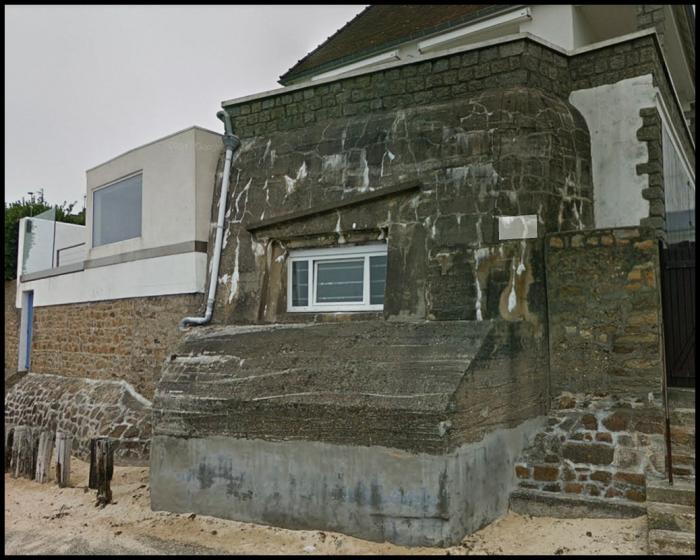
Mo 83, type 669
Article dans Wikipedia: http://fr.wikipedia.org/wiki/Mur_de_l'Atlantique
Villes proches:
Coordonnées : 48°40'25"N 3°55'23"W
- Bunker 6.6 km
- Bunker 6.7 km
- Bunker 6.7 km
- Bunker Mo 56c 10 km
- Bunker 11 km
- Bunker Mo 29 33 km
- Bunker 40 km
- Bunker 40 km
- Bunker Po 39b 60 km
- Bunker 64 km
- Baie de Morlaix 4 km
- Plouénan 7.9 km
- Taulé 8.4 km
- Plougoulm 9 km
- Mespaul 11 km
- Saint-Martin-des-Champs 12 km
- Plouvorn 13 km
- Guiclan 14 km
- St Thégonnec 17 km
- Finistère 49 km