Mouscron (municipality)
Belgium /
Hennegau /
Mouscron /
World
/ Belgium
/ Hennegau
/ Mouscron
municipality, draw only border


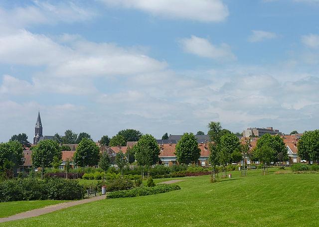


Mouscron (French: [mukʁɔ̃]; Dutch: Moeskroen, pronounced [muˈskrun], Picard: Moucron) is a Walloon municipality located in the Belgian province of Hainaut, along the border with the French city of Tourcoing, which is part of the Lille metropolitan area. The Mouscron municipality includes the old communes of Dottignies (Dottenijs), Luingne, and Herseaux (Herzeeuw). Mouscron is a municipality with language facilities for Dutch-speakers. Kortrijk, in Flanders, is located just north of Mouscron.
Wikipedia article: https://en.wikipedia.org/wiki/Mouscron
Nearby cities:
Coordinates: 50°44'16"N 3°15'14"E
- Kortrijk 16 km
- Menen (Municipality) 16 km
- Roeselare 31 km
- Zonnebeke (municipality) 31 km
- Heuvelland 39 km
- Ypres (municipality) 41 km
- Aalter (Municipality) 43 km
- Koekelare (municipality) 51 km
- Ichtegem (municipality) 51 km
- Diksmuide (municipality) 55 km
- Deleye Products 0.2 km
- Electricity pylon 3.4 km
- Saint Anthony the Abbot Church 3.5 km
- The unmanned Soviet MiG-23M "Flogger-B" crash site, on 4 July 1989. 4.7 km
- Saint Amand Church 4.8 km
- W.S. Bellegem 4.9 km
- Saint Lawrence Church 5.5 km
- Electricity pylon 5.9 km
- Elementary School 5.9 km
- Electricity pylon 6.6 km