Stenwith Bottom Lock (Number 13)
United Kingdom /
England /
Long Bennington /
Grantham Canal Towpath
World
/ United Kingdom
/ England
/ Long Bennington
lock (water navigation)
Add category
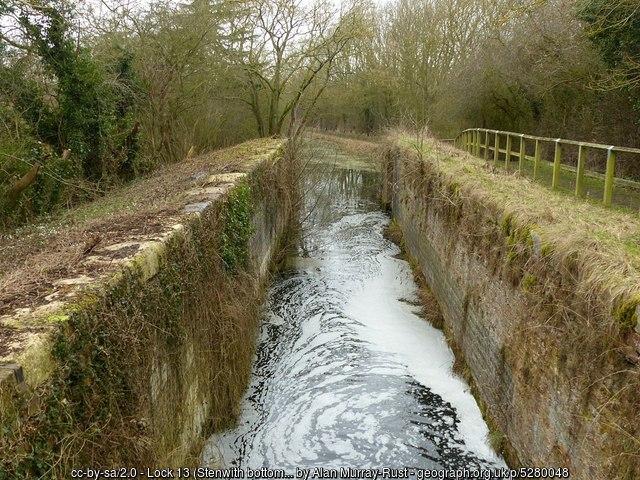
The third lock of the Woolsthorpe flight which raised the canal to its summit level. The walls of the chamber are still in reasonable condition, and the western side has recently been cleared of trees as part of the ongoing restoration. -Geograph.
Photo: www.geograph.org.uk/photo/5280048
Photo: www.geograph.org.uk/photo/5280048
Wikipedia article: https://en.wikipedia.org/wiki/Grantham_Canal
Nearby cities:
Coordinates: 52°55'11"N -0°45'18"E
- Haverholme Lock (disused) 30 km
- Belgrave Lock 44, Grand Union Canal (Leicester Section) 39 km
- Freeman’s Meadow Lock 41, River Soar (Grand Union Canal) 42 km
- Aylestone Mill Lock 39, River Soar (Grand Union Canal) 43 km
- Tythorn Lock 28, Grand Union Canal (Leicester Section) 46 km
- Kibworth Top Lock 18, Grand Union Canal (Leicester Section) 46 km
- Ervin’s Lock 32, Grand Union Canal (Leicester Section) 46 km
- Waternewton Lock No 35 48 km
- Martin Lock Horncastle Canal 51 km
- Dog-in-a-Doublet Lock No 38 57 km
- Casthorpe House Farm 2.5 km
- Belvoir High School 4 km
- Redmile PSD (North) 5.2 km
- Former RAF Bottesford 5.4 km
- Jericho Covert 6.8 km
- Orston Solar Field 7.3 km
- Kilvington 7.4 km
- Alverton 7.4 km
- Elton Solar Field 7.4 km
- Whatton United FC 7.6 km