Clear Creek Management Area
USA /
California /
San Lucas /
World
/ USA
/ California
/ San Lucas
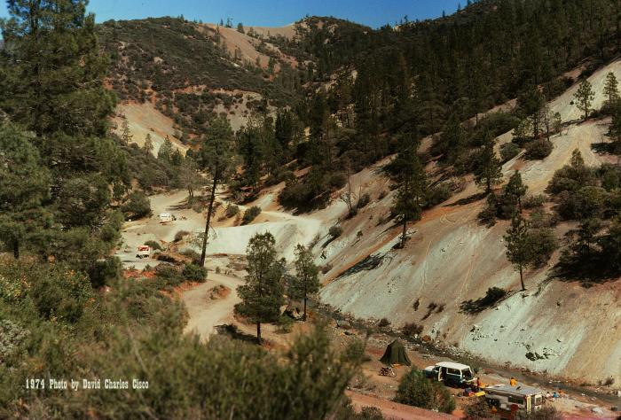
Clear Creek Management Area (CCMA) encompasses approximately 75,000 acres, of which 63,000 acres are public lands managed by the Bureau of Land Management Central Coast Field Office. Topography is rugged with elevations ranging from 1,830 feet at Pine Canyon to 5,241 feet on San Benito Mountain. The Mediterranean climate is punctuated by cool, wet winters and hot, dry summers. Annual precipitation occurs primarily as winter rain with some snow occurring most years at the highest elevations on San Benito Mountain.
Recreational opportunities include hunting, camping, hobby gem/mineral collecting, mountain biking, horseback riding, hiking/backpacking, and sightseeing. Hobby gem and mineral collectors are drawn to the Clear Creek area, one of the most highly mineralized areas in California, by the presence of over 150 semi-precious minerals and gemstones. Among these are serpentine, jadeite, cinnabar, tremolite, topazite, neptunite, and the extremely rare California state gem, benitoite.
www.recreation.gov/wildernessAreaDetails.do?contractCod...
www.riderplanet-usa.com/atv/trails/info/california_0366...
Nearby cities:
Coordinates: 36°21'50"N 120°45'29"W
- Alta Peak 8.4 km
- Private Airstrip 42 km
- ATV/Dirt Bike Course. 75 km
- Daou Vineyards 80 km
- Westlake Farms 81 km
- Red Cedar Vineyards 83 km
- temp 86 km
- Government Center 97 km
- Quay Valley 112 km
- Lost Hills Solar Farm 126 km
- New Idria Quicksilver Mining District 8.6 km
- San Benito Mountain Research Natural Area 10 km
- Coalinga Oil Field 39 km
- Tranquility Solar Facility 39 km
- Pine Creek Vineyard 40 km
- Cantua Creek, California 42 km
- Harris Feeding Company 45 km
- New Coalinga Municipal Airport (CLG) 47 km
- San Andreas Fault Zone 105 km
- San Andreas Fault Zone (approx) 113 km