Ferdows Hole-in-the-Rock
Iran /
Khorasan /
Ferdus /
World
/ Iran
/ Khorasan
/ Ferdus
, 37 km from center (فردوس)
mountain, landscape, landscaping, interesting place
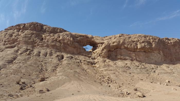
Ferdows Hole-in-the-Rock (Persian: سنگ سوراخ فردوس – Sang-e-Sourakh Ferdows) is a natural geological formation 35 km (22 mi) west of Ferdows, South Khorasan Province, Iran.
Description[edit]
Ferdows Hole-in-the-Rock is an elliptical opening around 20 metres (66 ft) wide eroded in a Limestone hill.[1]
The formation is a popular attraction in the Mozaffari protected area in Ferdows County. This natural attraction, locates 500 meters besides the old road of Ebrahimabad to Kajeh, Chahno and Polond desert.
Wikipedia article: https://en.wikipedia.org/wiki/Ferdows_Hole-in-the-Rock
Nearby cities:
Coordinates: 34°8'50"N 57°50'24"E
- Ferdows-Gonabad Mountains-2850 m 49 km
- Boshrooyeh - Tabas Mountains 77 km
- Kabir Koh - 2000 m 156 km
- Shasko VASFAND Mountian - 2820 m 177 km
- Baghraan Mountains, 2690 m 183 km
- Darmian Mountain 200 km
- Mirza Arab Mountian - 2840 m 206 km
- Peyghanbar Mountain 214 km
- Ush Rah Landscape (The Rainbow Landscape) 221 km
- Binalood Mountain Range, 3310 m 276 km