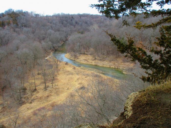
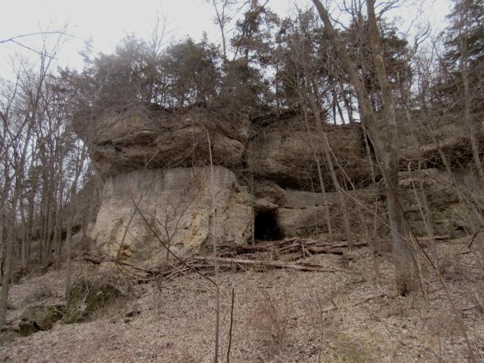
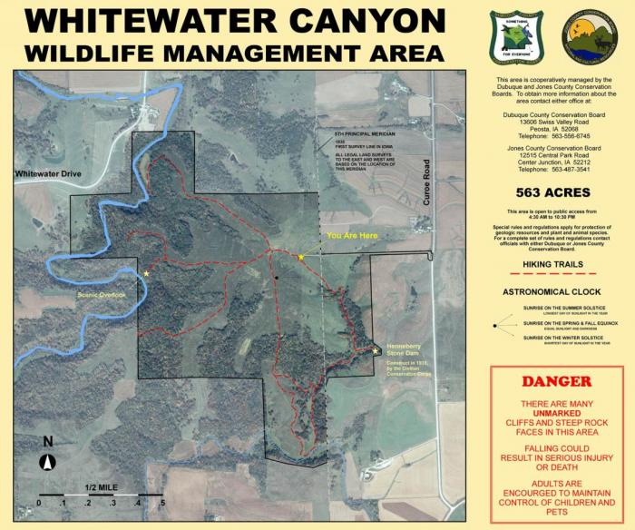
Whitewater Canyon Wildlife Management Area
USA /
Iowa /
Bernard /
World
/ USA
/ Iowa
/ Bernard
Location
Located 5 miles east of Cascade. Take Hwy 151 east and turn south onto Curoe Road. Follow the familiar brown county conservation board arrowhead signs. Keep traveling south on Curoe Road until it turns to gravel. (Do not follow curve on highway.) Turn right into the parking lot. - See more at: www.mycountyparks.com/County/Jones/Park/Whitewater-Cany...
Located 5 miles east of Cascade. Take Hwy 151 east and turn south onto Curoe Road. Follow the familiar brown county conservation board arrowhead signs. Keep traveling south on Curoe Road until it turns to gravel. (Do not follow curve on highway.) Turn right into the parking lot. - See more at: www.mycountyparks.com/County/Jones/Park/Whitewater-Cany...
Nearby cities:
Coordinates: 42°17'32"N 90°54'12"W
- Perry Township, Jackson County, IA 22 km
- Key West (unincorportated town) 29 km
- Port Of Dubuque 33 km
- Rickardsville, Iowa 33 km
- White Pine Hollow State Forest Preserve 43 km
- UPPER MISSISSIPPI RIVER NATIONAL WILDLIFE & FISH REFUGE 44 km
- Ram Hollow Wildlife Management Area 45 km
- Green Island Wildlife Management Area 50 km
- UPPER MISSISSIPPI RIVER NATIONAL WILDLIFE & FISH REFUGE 50 km
- UPPER MISSISSIPPI RIVER NATIONAL WILDLIFE & FISH REFUGE 61 km
- Indian Bluffs Wildlife Management Area 16 km
- Pictured Rocks Wildlife Management Area 19 km
- Dubuque Regional Airport (DBQ/KDBQ) 20 km
- Maquoketa Caves State Park 22 km
- South End District 27 km
- Langworthy, Iowa 29 km
- College Grandview District 30 km
- Wapsipinicon State Park 38 km
- Stone City, Iowa 42 km
- Delaware County 43 km