Second Mill (Cromford)
United Kingdom /
England /
Cromford-Matlock Bath /
Cromford
World
/ United Kingdom
/ England
/ Cromford-Matlock Bath
historic ruins
Add category
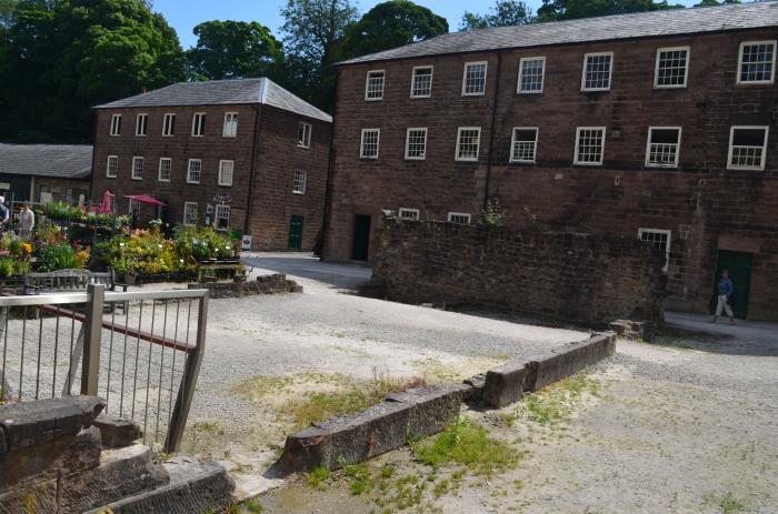
The ruined second mill at Cromford Mill. The foundations and cavity for the water wheel are still visible. It was destroyed by fire in 1890.
Wikipedia article: https://en.wikipedia.org/wiki/Cromford_Mill
Nearby cities:
Coordinates: 53°6'32"N 1°33'20"W
- Sheep Pasture Incline 1 km
- Butterley Tunnel (Derelict) 11 km
- Former POW Camp 95 km
- Remains of Revesby Cistercian Abbey 100 km
- Duncombe Park Army Camp 130 km
- Ingleby Incline 150 km
- Royal Air Force Danby Beacon Radar Station 159 km
- No 81 Maintenance Unit, RAF Bowes Moor 161 km
- Halton Medieval Village 213 km
- Girvan Junction 321 km
- Cromford Meadows 0.5 km
- Bolehill 2 km
- Dethick, Lea and Holloway 2.6 km
- Wirksworth Moor 2.8 km
- Shining Cliff Woods 3.7 km
- Alport Height 5.5 km
- Blackbrook 10 km
- Cross o' th' Hands 10 km
- Shottle Gate 10 km
- Butterley Reservoir 11 km