Fold
Syria /
Hhims /
al-Qaryatayn /
World
/ Syria
/ Hhims
/ al-Qaryatayn
, 28 km from center (القريتين)
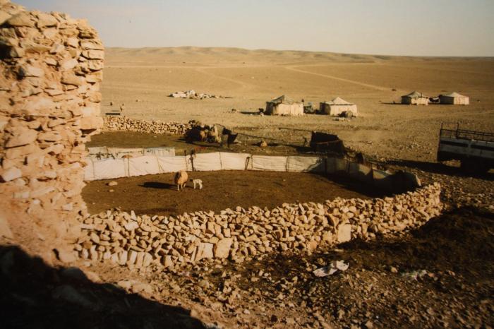
local beduines use the Khan's walls and built a fold for their lifestock.
Nearby cities:
Coordinates: 33°54'55"N 37°14'50"E
- Afa'i Spring (Well) 28 km
- معسكر تدريب عسكري 31 km
- Bir Mahrutha 31 km
- Jabal Abū Dālī (1004,2) 8.8 km
- Jabal Zubaydi (1390) 21 km
- Jabal Maksar as-Samr / an-Namr (1340) 21 km
- Line of the war shooting between the SAA and the fighters of IS 23 km
- Jebel Batra (1214,8) 36 km
- Jabal ad-Dumayr 46 km
- Al-Qaryatayn Subdistrict (PCS) 51 km
- Rif Dimashq Governorate (PCS) 54 km
- al-Qalamoun Mountains/Northern Anti-Lebanon 65 km
- Saba Biyar Subdistrict (PCS) 79 km
Jabal Abū Dālī (1004,2)
Jabal Zubaydi (1390)
Jabal Maksar as-Samr / an-Namr (1340)
Line of the war shooting between the SAA and the fighters of IS
Jebel Batra (1214,8)
Jabal ad-Dumayr
Al-Qaryatayn Subdistrict (PCS)
Rif Dimashq Governorate (PCS)
al-Qalamoun Mountains/Northern Anti-Lebanon
Saba Biyar Subdistrict (PCS)