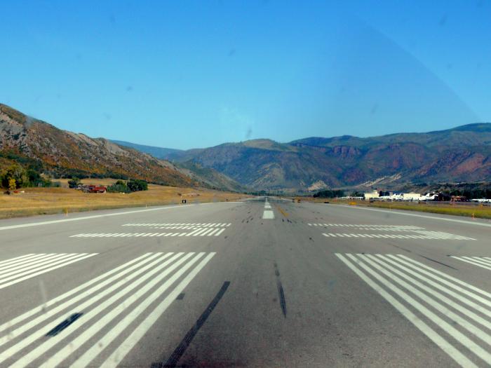
Runway 15/33
USA /
Colorado /
Aspen /
World
/ USA
/ Colorado
/ Aspen
runway
Add category
Runway 15/33
Dimensions: 8006 x 100 ft. / 2440 x 30 m
Surface: asphalt/grooved, in good condition
Weight bearing capacity:
PCN 28 /F/B/X/U
Single wheel: 80.0
Double wheel: 100.0
Double tandem: 160.0
Runway edge lights: medium intensity
RUNWAY 15 RUNWAY 33
Latitude: 39-13.930572N 39-12.694813N
Longitude: 106-52.388905W 106-51.799202W
Elevation: 7680.3 ft. 7837.9 ft.
Traffic pattern: left right
Runway heading: 151 magnetic, 160 true 331 magnetic, 340 true
Displaced threshold: no 1000 ft.
Declared distances: TORA:7006 TODA:7006 ASDA:7006 LDA:7006 TORA:8006 TODA:8006 ASDA:8006 LDA:7006
Markings: nonprecision, in good condition nonprecision, in good condition
Visual slope indicator: 4-light PAPI on left (3.50 degrees glide path)
PAPI UNUSBL BYD 4 NM FM RWY THR & BYD 7 DEGS RIGHT OF RWY CNTRLN.
Approach lights: MALSF: 1,400 foot medium intensity approach lighting system with sequenced flashers
Runway end identifier lights: no yes
Touchdown point: yes, no lights yes, no lights
Instrument approach: LOC/DME
Obstructions: none 22 ft. road, 1100 ft. from runway, 550 ft. left of centerline, 40:1 slope to clear
Nearby cities:
Coordinates: 39°13'18"N 106°52'5"W
- 04V Saguache Municipal Airport 138 km
- Runway 11L/29R 168 km
- 33V Walden-Jackson County Airport 178 km
- 7CO3 Buffalo Airport 185 km
- C08 Silver West Airport 186 km
- Runway 14/32 189 km
- Runway 12/30 -(Peterson AFB) 191 km
- Runway 2/20 216 km
- Melby Ranch Airstrip (33CO) 268 km
- Runway 12/30 318 km
- Aspen-Pitkin County Airport (ASE/KASE) 0.1 km
- Starwood Metropolitan District 2.2 km
- Maroon Creek Club 2.6 km
- Aspen Golf & Tennis Club 3.3 km
- Aspen Highlands & Buttermilk 5.2 km
- Aspen Mountain Ski area 7.2 km
- Cyclone Mountain 18 km
- Ruedi Reservoir 18 km
- Meredith, Colorado 20 km
- Upper Colorado 39 km