Warragul
Australia /
Victoria /
Warragul /
World
/ Australia
/ Victoria
/ Warragul
World / Australia / Victoria
town
Add category
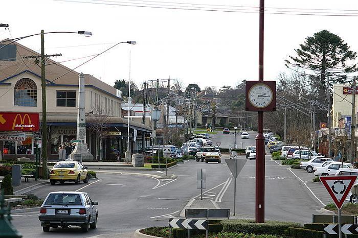
Warragul is a rural centre with a population of 12,943 people, 104 kilometres (65 mi) east-southeast of Melbourne in Victoria. Warragul lies between the Strzelecki Ranges to the south and the Mount Baw Baw Plateau of the Great Dividing Range to the north. The town is named after an Aboriginal word meaning "wild dog".
Warragul is the main population and service centre of the West Gippsland region and the Shire of Baw Baw. The surrounding area is noted for dairy farming and other niche agriculture and has long been producing gourmet foods.
Warragul is the main population and service centre of the West Gippsland region and the Shire of Baw Baw. The surrounding area is noted for dairy farming and other niche agriculture and has long been producing gourmet foods.
Wikipedia article: http://en.wikipedia.org/wiki/Warragul,_Victoria
Nearby cities:
Coordinates: 38°8'56"S 145°55'25"E
- Clyde 55 km
- Reservoir, VIC 3073 105 km
- Whittlesea 110 km
- Beveridge Vic 122 km
- Sunbury 136 km
- Lara VIC 3212 140 km
- Little River 141 km
- Warracknabeal 385 km
- Kangarilla 736 km
- Iron Knob 1007 km
- Nayook 25 km
- Blue Rock Dam 26 km
- Nar Nar Goon 32 km
- Shire of Cardinia 32 km
- Nar Nar Goon North (Part) 33 km
- Strzelecki Ranges 47 km
- Western Port 53 km
- Yarra Ranges Shire 55 km
- Greater Melbourne 75 km
- Melbourne 87 km
Comments