Long Eaton School Footbridge (Long Eaton)
United Kingdom /
England /
Long Eaton /
B6540 Tamworth Road
World
/ United Kingdom
/ England
/ Long Eaton
footbridge
Add category
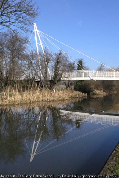
Carries a footpath to Long Eaton School over the Erewash Canal.
Photo: www.geograph.org.uk/photo/692302
Photo: www.geograph.org.uk/photo/692302
Wikipedia article: https://en.wikipedia.org/wiki/The_Long_Eaton_School#New_site
Nearby cities:
Coordinates: 52°53'31"N 1°16'38"W
- Bridge No.5 0.5 km
- Cole Lane Footbridge 6.6 km
- Footbridge 8.9 km
- Wilford Suspension Bridge 10 km
- Wilford Toll Bridge 10 km
- Footbridge 10 km
- Foot Bridge 21 km
- Aylestone Old Bridge 33 km
- Viersen Platz Footbridge 78 km
- Millennium Bridge 82 km
- West Park 0.6 km
- Trent Lock Golf & Country Club 1.6 km
- Toton Yard and depot 2.1 km
- Thrumpton Hall 2.6 km
- Severn Trent Water Works 2.6 km
- Attenborough Nature Reserve 2.8 km
- Chetwynd Army Barracks 2.9 km
- Attenborough 3.4 km
- Ratcliffe on Soar Power Station 3.4 km
- Chilwell 3.9 km