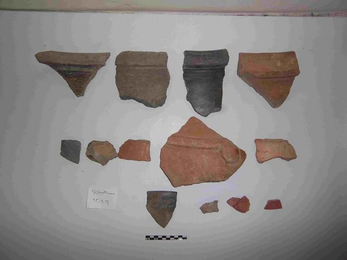
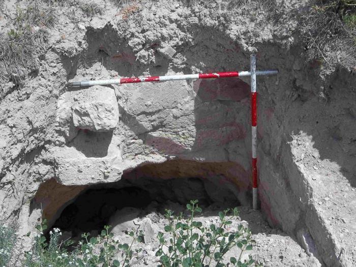
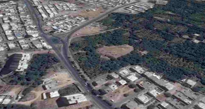
3000 BC - Tapali Bagh Hill ( تپه باستانی تپلی باغ ﻣﺮﺍﻏﻪ) (Maragheh)
Iran /
Azarbayejan-e Sharqi /
Maragheh
World
/ Iran
/ Azarbayejan-e Sharqi
/ Maragheh
, 4 km from center (مراغه)
hill, ancient, archaeological site
Nearby cities:
Coordinates: 37°23'38"N 46°15'18"E
- Khorshid The Rainbow Landscape 59 km
- Panjeye Rıg-e Jenn Desert (The walls of the five sand Dunes) 734 km
- Hezarpa Hills 740 km
- cheshm2 792 km
- cheshm1 814 km
- Jangal-e tape Lut Lansdcape 1278 km
- Alzubna Hill 1316 km
- Kajīr Marko Hill Station 2086 km
- Garuki Hills 2167 km
- Bhat Koh/Bhat Hills 2204 km
- Settlements Valieasr 1.9 km
- Settlements Golshar 2.1 km
- Walnut orchards, plums and apples, the northern city of Maragheh 3 km
- Sinjan Mount 3.5 km
- Gardens, ( orchards walnut, plum and apple) - the southern city of Maragheh 4.4 km
- Valley of the Mordigh River (Dayti) 5.2 km
- Maragheh Plain 5.5 km
- Alavian Dam Reservoir 5.5 km
- gardens Grape vines south of Maragheh 6.2 km
- Valley of the Sofi Chay (Maragheh) River 22 km
Settlements Valieasr
Settlements Golshar
Walnut orchards, plums and apples, the northern city of Maragheh
Sinjan Mount
Gardens, ( orchards walnut, plum and apple) - the southern city of Maragheh
Valley of the Mordigh River (Dayti)
Maragheh Plain
Alavian Dam Reservoir
gardens Grape vines south of Maragheh
Valley of the Sofi Chay (Maragheh) River