Tour
France /
Rhone-Alpes /
La Garde-Adhemar /
World
/ France
/ Rhone-Alpes
/ La Garde-Adhemar
tour, fortification, Monument classé, city wall (en)
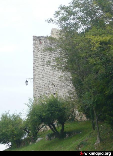
des remparts du XIIIe siècle
Article dans Wikipedia: http://fr.wikipedia.org/wiki/La_Garde-Adhémar#Lieux_et_monuments
Villes proches:
Coordonnées : 44°23'38"N 4°45'12"E
- Tour du Jacquemart 50 km
- Tour et mur d'enceinte 75 km
- Truc de Fortunio 101 km
- Tour CMA CGM 130 km
- le Saint-Georges 132 km
- Tour du Grand-Pavois 135 km
- Résidence Valmante 138 km
- Tour Barberousse 196 km
- Tours de Carbonnières 222 km
- Manoir de la Vermondie 298 km
- Aéroclub du Tricastin LFHD 3 km
- Site nucléaire du Tricastin 6.8 km
- Bourg-Saint-Andéol 10 km
- VIVIERS SUR RHONE 11 km
- Richerenches 13 km
- Grillon 14 km
- Domaine d'Imbours 14 km
- Carrière de pierre à chaux de Lafarge 15 km
- Golf de la VALDAINE 17 km
- Montélimar 18 km