Osaka-shita Signal and Crosswalk (Yokohama)
Japan /
Kanagawa /
Kamakura /
Yokohama
World
/ Japan
/ Kanagawa
/ Kamakura
crosswalk
Add category
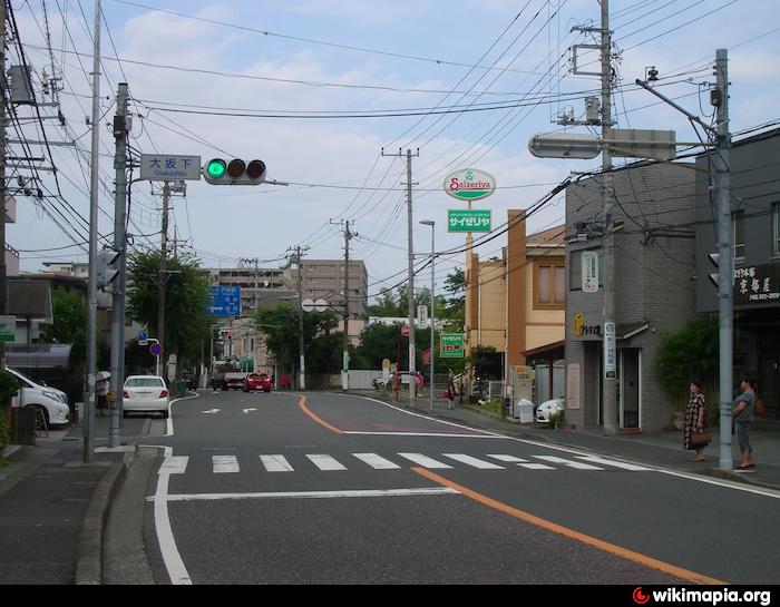
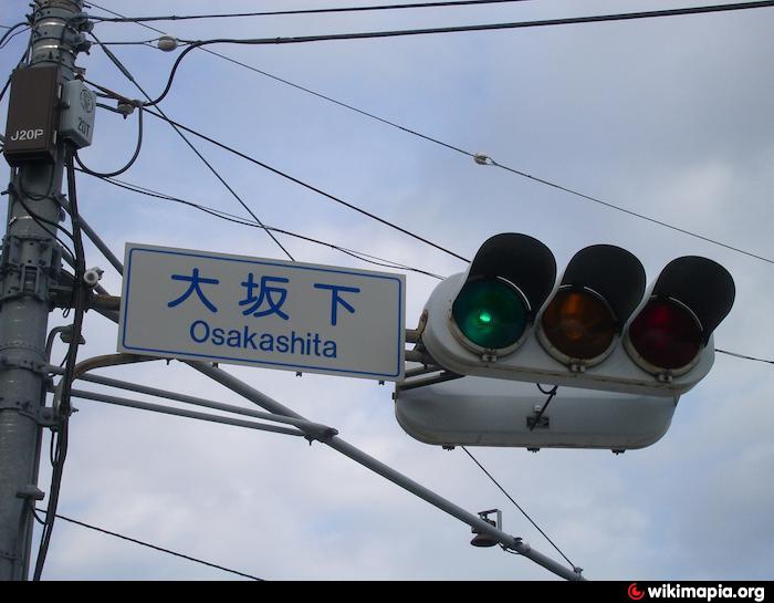
A crosswalk with a push-button actuated traffic signal on the Tokaido Highway.
The name given to it means “bottom (shita) of the Large Hill (Osaka)”.
The name given to it means “bottom (shita) of the Large Hill (Osaka)”.
Nearby cities:
Coordinates: 35°23'34"N 139°31'35"E
- Dongguk University Station Crossing 1145 km
- Sinyongsan Station Crossing 1148 km
- Sky Bridge 2876 km
- Batasan Footbridge 2950 km
- Pedestrian Pathway 2964 km
- Ayala-Paseo de Roxas Underpass 2966 km
- Sheltered Path 4707 km
- Pedestrian Bridge 5289 km
- Pedestrian Overpass 5304 km
- Pedestrian 5331 km
- Totsuka High School 1.1 km
- Totsuka-ku (ward) 1.2 km
- Torigaoka Elementary School 2.1 km
- Navy Radio Transmitting Facility, Totsuka 2.3 km
- NRTF Totsuka Restricted Area 2.4 km
- Matano Park 3.2 km
- Ryoke Park 3.3 km
- Nakawada Junior High School 3.6 km
- Izumi-ku (ward) 3.7 km
- Kanagawa Prefectural Shuyukan High School 3.8 km