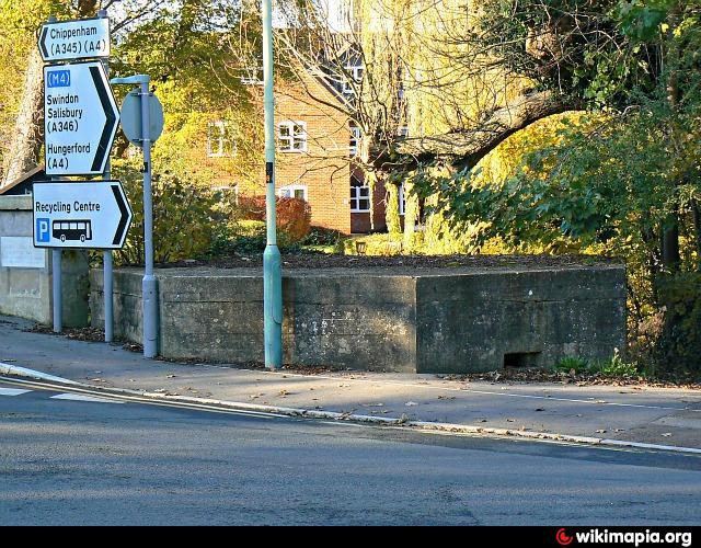
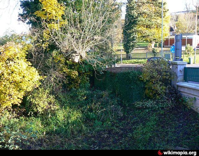
Pillbox (Marlborough)
United Kingdom /
England /
Marlborough
World
/ United Kingdom
/ England
/ Marlborough
pillbox
Add category
Nearby cities:
Coordinates: 51°24'58"N 1°43'56"W
- Position of two World War 2 Pillboxes 74 km
- WW2 Pillbox 106 km
- Tank Gun Pillbox 124 km
- Jäger stand 190 km
- Pillboxes 571 km
- Bunker and trenches 1186 km
- Department of Motor Vehicles 7011 km
- Fuerte de San Carlos 7672 km
- Pithouse Ruin 8283 km
- California Highway Patrol - Rainbow Inspection Facility (686) 8685 km
- Marlborough College 0.3 km
- Thames Water Sewage Treatment Works 1.5 km
- Marlborough Golf Club 1.8 km
- Savernake Forest 4 km
- Ogbourne Downs Golf Club 6.8 km
- Ramsbury Manor 7.3 km
- Snap Farm 8.3 km
- Draycott Farm Grass Airfield 8.6 km
- Preston 10 km
- Peaks Wood 13 km