National Park of American Samoa (Tutuila)
American Samoa /
Eastern /
Leloaloa /
World
/ American Samoa
/ Eastern
/ Leloaloa
coral reef, rainforest, nature conservation park / area, national park
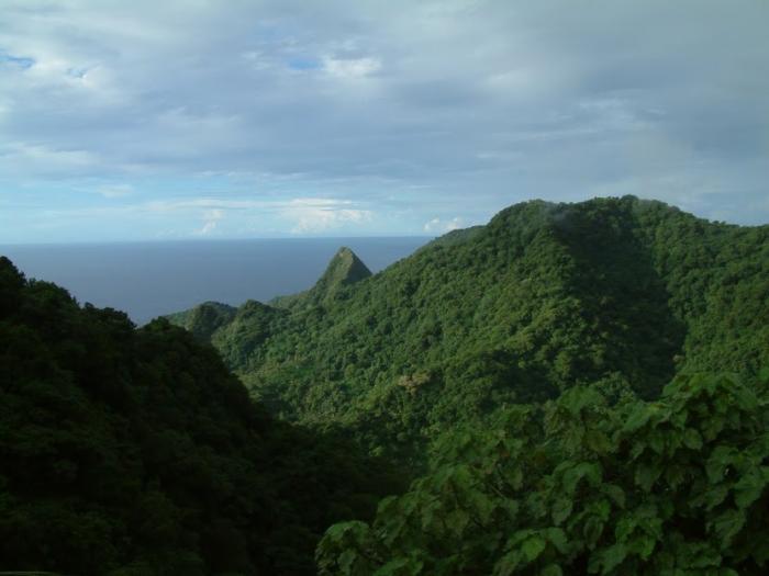
The National Park of American Samoa is distributed across three separate islands: Tutuila, Ofu-Olosega, and Ta‘ū. The park includes coral reefs and rain forest and is popular for hiking, snorkeling, and scuba diving, although the primary purpose of the park is that of preservation of Samoa's unique natural resources. It is the only American national park south of the equator.
The Tutuila unit of the park is on the north end of the island near Pago Pago. It is the only part of the park accessible by car and attracts the majority of visitors. The park lands include a trail to the top of Mount Alava and historic World War II gun emplacement sites at Breakers Point and Blunt's Point.
www.nps.gov/npsa
Wikipedia article: http://en.wikipedia.org/wiki/National_Park_of_American_Samoa
Nearby cities:
Coordinates: 14°15'24"S 170°41'15"W
- Los Glaciares National Park 9327 km
- Nahuel Huapi National Park 9723 km
- Lanín National Park 9766 km
- Manu National Park 10582 km
- Alto Purús National Park 10622 km
- Madidi National Park 10872 km
- National Park and Indigenous Territory Isiboro Securé 11046 km
- Carrasco National Park 11088 km
- Amboró National Park 11172 km
- Kaa-Iya del Gran Chaco National Park 11389 km
- Tutuila 5.7 km
- Nu'uuli 6.8 km
- Faga'itua Bay 8 km
- Pago Pago International Airport (NSTU) 9 km
- Samoan Islands 58 km
- Aleipata 87 km
- Afulilo Dam 98 km
- Fagaloa 100 km
- Upolu 120 km
- Samoa 162 km