Azadshahr
Iran /
Golestan /
Azad Shahr /
World
/ Iran
/ Golestan
/ Azad Shahr
, 1 km from center (آزادشهر)
city
Add category


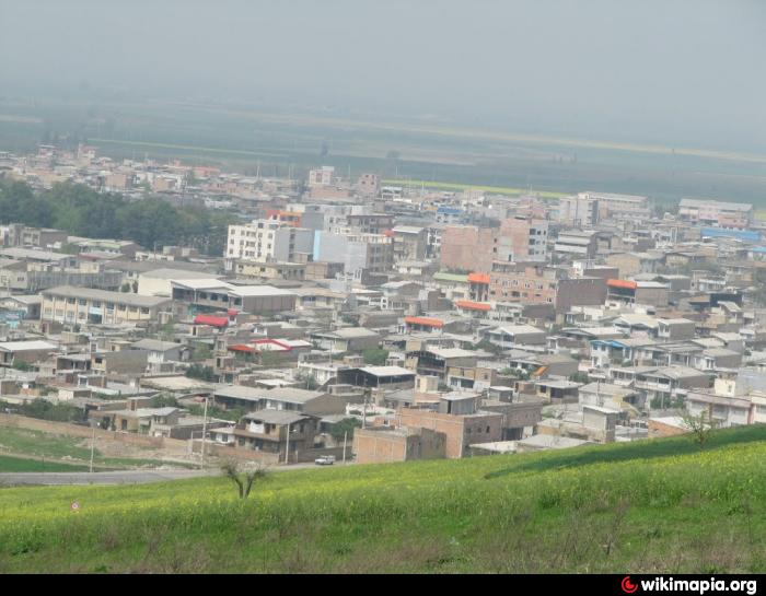


The city was formerly called ghare Tekken. The village due to being on the road for a four citizens Mashhad Iran's dome and gradually grew to become the city's main road. During the regime of Shah Pahlavi, the bread was shah pasand and the whole city was liberated after the Islamic Revolution. The city is a mix of ethnicities that live together in peace. Among the city's ethnic Persians, Turks, Turkmen, Baluch and Sistani, the tone name. Fares are often living in this city from nearby villages have migrated to different cultures. In the Gulf of Mhajrbh It can Sabzevar anymore) Khij, Semnan and Kalateh Khij (and Ghouchan name
Wikipedia article: http://en.wikipedia.org/wiki/Azadshahr
Nearby cities:
Coordinates: 37°5'11"N 55°10'15"E
- Gonbad-e Kavus 22 km
- Aqqala- 66 km
- Gorgan 77 km
- Bandar Torkaman 102 km
- Balkanabat 283 km
- Noshahr 332 km
- AbbasAbad 367 km
- Turkmenbashi 383 km
- Tonekabon 387 km
- Ramsar, Mazandaran 403 km
- Shahr Park 1 km
- kelow (كلو) 4.8 km
- okhli froudgah (اخلي فرودگاه) 6.6 km
- روستاي چاله پلرز 6.9 km
- okhli bala (اخلي بالا) 7.4 km
- باغ عرب عامری 7.7 km
- زمین های کشاورزی مشهد شاه رضا 7.9 km
- okhli paein(اخلي پايين) 8.7 km
- Forest Park 8.9 km
- fajr (روستاي فجر) 9 km