Town gate
Switzerland /
Basel-Landschaft /
Waldenburg /
World
/ Switzerland
/ Basel-Landschaft
/ Waldenburg
city gate, historical building
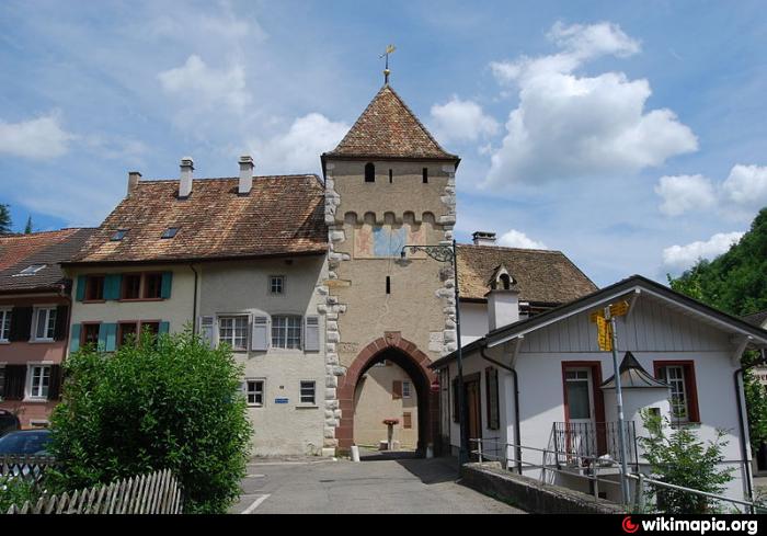
At medieval time it was the gate of Waldenburg, and also a post that controlled the transit traffic via the Frenke valley.
Nearby cities:
Coordinates: 47°22'54"N 7°44'48"E
- Gasthof zum Schlüssel 0.1 km
- Church St Etienne 30 km
- Town Hall - Blotzheim 31 km
- Church Saint-Laurent 37 km
- St. Stephen - Munzingen 65 km
- Peterhof 69 km
- St.Martin - Hochdorf 75 km
- Vorderösterreich Museum 85 km
- Old Castle Heimbach 87 km
- Church 116 km
- Langenbruck BL 3.1 km
- Mümliswil-Ramiswil SO 7.2 km
- Balsthal SO 8.2 km
- Canton Basel-Landschaft 11 km
- Oensingen SO 11 km
- Olten, SO 13 km
- Lostorf, SO 14 km
- Murgenthal, AG 16 km
- Canton Aargau 26 km
- Canton Bern 63 km