Tsatsa
Greece /
Karditsa /
Rentina /
World
/ Greece
/ Karditsa
/ Rentina
, 9 km from center (Ρεντίνα)
recreation area / ground, locality (geography), invisible
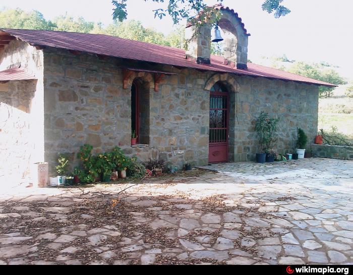
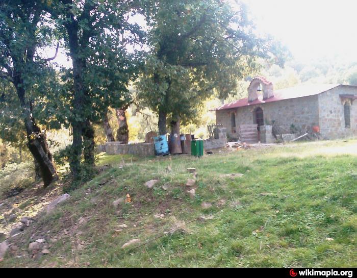
Area Tsatsa of Rentina
Previously there was a settlement (with name Tsatsa) mainly farmers. Few traces of Tsatsa settlement survived to our time.
A Church of the Apostles Peter and Paul was built few years ago.
39.0547 N 220746 E Altitude 746 m.
Previously there was a settlement (with name Tsatsa) mainly farmers. Few traces of Tsatsa settlement survived to our time.
A Church of the Apostles Peter and Paul was built few years ago.
39.0547 N 220746 E Altitude 746 m.
Nearby cities:
Coordinates: 39°3'34"N 22°3'30"E
- Livadia Tsouka 7.4 km
- Aghia Paraskevi-Mezourlo Area 68 km
- Mezourlo Park 69 km
- Municipal Recreation Park 73 km
- A.Tritsis Metropolitan Park 183 km
- Nèa Philadelphia Park 185 km
- Fonias 345 km
- Carney Park 707 km
- Tisan Holiday Village 1073 km
- Serpentona 1555 km
- Paliokaitsa. 6.7 km
- Rovoliari 8.3 km
- Thermiotika 10 km
- Dikastron 12 km
- ancient Makrakomi 12 km
- Ptelea local community region 13 km
- Area St. George local community 14 km
- Peripheral unit of Karditsa 34 km
- Peripheral unit of Phthiotis 51 km
- Peripheral unit of Aetolia-Acarnania 69 km