Taz Estuary
Russia /
Jamalo-Nenets /
Tazovskiy /
World
/ Russia
/ Jamalo-Nenets
/ Tazovskiy
, 91 km from center (Тазовский)
World
estuary
Add category
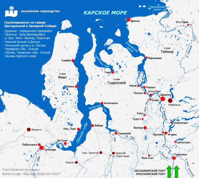
The Taz Estuary is a long gulf formed by the Taz River. It consists of a roughly 250-kilometer (160 mi) long estuary that begins in the area of the settlement of Tazovsky and ends in the Gulf of Ob, which is connected with the Kara Sea. Its average width is about 25 kilometers (16 mi) and it is one of the biggest estuaries in the world.
Wikipedia article: http://en.wikipedia.org/wiki/Taz_Estuary
Nearby cities:
Coordinates: 67°53'5"N 77°53'29"E
- Yenisey Gulf 461 km
- Sarmik River 760 km
- Talata Karskaya river 765 km
- Krutoi Stream 774 km
- Heheyaha River 803 km
- Yurkharovo 37 km
- Confluence Point of 68N 77E 39 km
- Confluence Point of 68N 76E 80 km