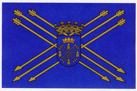
Caguas
Puerto Rico /
Humacao /
Caguas /
World
/ Puerto Rico
/ Humacao
/ Caguas
World / Puerto Rico
city, municipality

Caguas, founded in 1775, is a city and municipality of Puerto Rico located in the Central Mountain Range of Puerto Rico, south of San Juan and Trujillo Alto, west of Gurabo and San Lorenzo, east of Aguas Buenas, Cidra, and Cayey.
Caguas is located 20 miles (32 km) (twenty minutes to an hour by car) from San Juan and 40 miles (64 km) (an hour and a half by car; it may take longer because of mountainous area in between the two cities) from Ponce. It is known as El Valle del Turabo (Turabo Valley) or La Ciudad Criolla (The Creole City) and its name originates from the Taíno cacique Caguax. Caguas is both a principal city of the San Juan-Caguas-Guaynabo Metropolitan Statistical Area and the San Juan-Caguas-Fajardo Combined Statistical Area.
Caguas is located 20 miles (32 km) (twenty minutes to an hour by car) from San Juan and 40 miles (64 km) (an hour and a half by car; it may take longer because of mountainous area in between the two cities) from Ponce. It is known as El Valle del Turabo (Turabo Valley) or La Ciudad Criolla (The Creole City) and its name originates from the Taíno cacique Caguax. Caguas is both a principal city of the San Juan-Caguas-Guaynabo Metropolitan Statistical Area and the San Juan-Caguas-Fajardo Combined Statistical Area.
Wikipedia article: https://en.wikipedia.org/wiki/Caguas,_Puerto_Rico
Nearby cities:
Coordinates: 18°12'46"N 66°3'27"W
- Utuado 83 km
- Guayana City 1141 km
- Boa Vista 1795 km
- Calçoene 2332 km
- Amapá 2434 km
- Ferreira Gomes 2503 km
- Cutias 2516 km
- Macapá 2559 km
- Santana 2562 km
- Itaubal 2567 km
- Villa Nueva 0.5 km
- Parcelas Villa Esperanza 0.8 km
- Mariolga 2.3 km
- Mansiones en Caguas Real 3.2 km
- Pueblo 3.6 km
- José Mercado 4.3 km
- La Pradera 4.3 km
- Villas de Castro & Alturas del Turabo 5.1 km
- Aguas Buenas Cave System Nature Preserve 5.3 km
- Veredas 6 km
Comments