Mt Aricha: Southern ATC Command Centre
| Israel Defense Forces (IDF), aerospace industry, early warning radar
Israel /
Hadarom /
Mizpe Ramon /
World
/ Israel
/ Hadarom
/ Mizpe Ramon
World / Israel
Israel Defense Forces (IDF), aerospace industry, early warning radar


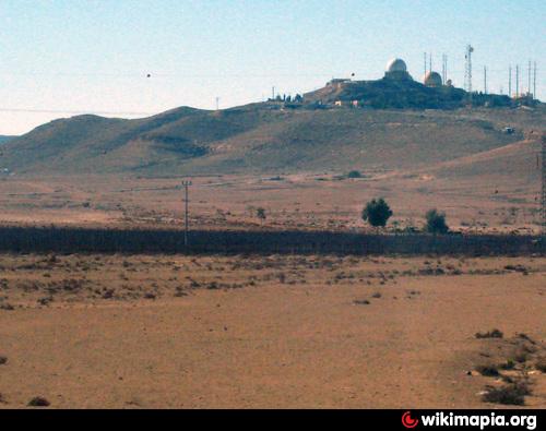
IAF Aerospace Defence Radar Command & Control Facility serving the whole of Southern Israel and the Sinai beyond.
Utilises Tadiran's Air Traffic Control Communication System (ATCCS). The system integrates wideband communications with short and long range radio communications, to provide Local and Wide Area Network (LAN/WAN) telephone, intercom, high-speed data, video and radio services.
iaf.co.il/2570-35083-he/IAF.aspx
Wikipedia article: http://he.wikipedia.org/wiki/יב"א_511
Nearby cities:
Coordinates: 30°39'12"N 34°46'54"E
- IAF Ramon Airbase 21 km
- Mahane (Camp) Ahdir 32 km
- Nevatim Airbase 66 km
- Tze'elim Army Base (MATBAT-B) : IDF Tactical Training Center (TTC) 66 km
- Hatzerim Airbase 71 km
- Ovda IAF Airbase & International Airport 76 km
- IAF Hatzor Airbase (ICAO: LLHS) 126 km
- Sdot Micha Airbase 128 km
- Tel Nof Airbase 134 km
- IAF Palmachim Airbase 143 km
- Makhtesh Ramon 8.1 km
- Negev 15 km
- Har Ardon 19 km
- Har Hamran 21 km
- Nitsana Stream 27 km
- Zin Desert 36 km
- Har Karkom 41 km
- Desert of Paran 53 km
- Nature Reserve 59 km
- Wadi Araba 62 km