Site of Awre for Blakeny train station *Closed*
United Kingdom /
England /
Cinderford /
World
/ United Kingdom
/ England
/ Cinderford
World / United Kingdom / England
historical layer / disappeared object, railway junction, former train/railway station

Opened - 19th September 1851
Closed - 10th August 1959
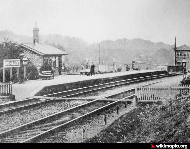
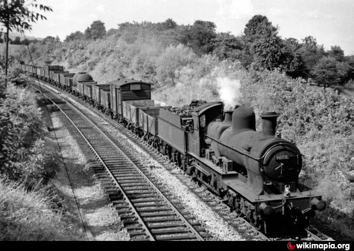
Sited about a mile from the village's of Awre and Blakeny, the station here was opened along with the South Wales line from Gloucester to Chepstow. Its name varied over the years, with Awre for Blakeny being the usual, however Awre Junction was used at one point. It became a junction with the opening of the Forest of Dean Central Railway in 1868
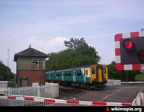
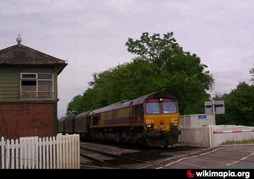
The station had 2 short platforms that were sited directly south of the level crossing. The actual junction for the Forest of Dean Central Railway was just north of the level crossing. After the closer of Awre and Blakeny, the coal depot on this site continued to operate until it to was closed on the 11th of September 1961.
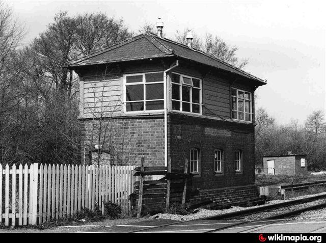
The only remains of the site is the now derelict signal box, just north of the level crossing.
Closed - 10th August 1959
Sited about a mile from the village's of Awre and Blakeny, the station here was opened along with the South Wales line from Gloucester to Chepstow. Its name varied over the years, with Awre for Blakeny being the usual, however Awre Junction was used at one point. It became a junction with the opening of the Forest of Dean Central Railway in 1868
The station had 2 short platforms that were sited directly south of the level crossing. The actual junction for the Forest of Dean Central Railway was just north of the level crossing. After the closer of Awre and Blakeny, the coal depot on this site continued to operate until it to was closed on the 11th of September 1961.
The only remains of the site is the now derelict signal box, just north of the level crossing.
Nearby cities:
Coordinates: 51°45'45"N 2°26'58"W
- Canadian Pacific Railway through Lindsay (GB&S & LB&P) 5471 km
- Former CN Coboconk Sub between Blackwater Jct. Coboconk via Cannington 5472 km
- Both old Midland Railway Routes West Out of Lindsay out of Lindsay 5475 km
- CNR Uxbridge Sub/ Whitby, Port Perry, And Lindsay Railway from Manilla Jct. to Lindsay (With Mariposa Industries Marked) 5486 km
- Whitby, Port Perry, and Lindsay Railway between Port Perry and Manilla Jct. 5492 km
- Former CN Uxbridge Sub Between Blackwater Jct. and Manilla Jct. 5495 km
- CNR Uxbridge Sub/ Toronto Nippissing Railway between Uxbridge and Blackwater Jct. 5505 km
- Original Grand Trunk Railway Route 5505 km
- Whitby, Port Perry, and Lindsay Railway between North Whitby and Myrtle Jct./Crossing 5510 km
- Branchville, South Carolina 6418 km
- Awre Solar Field 0.8 km
- Purton Hulks 3 km
- Purton Timber Pond 3.4 km
- Severn Bore, West England 3.5 km
- Site of Berkeley Castle's old duck decoy pond 3.6 km
- Purton Water Treatment Works 3.6 km
- Slimbridge Wildfowl Trust 3.9 km
- Tudor Caravan Park 4.7 km
- Meredith R A & Son Nurseries Ltd 5 km
- Rectory Farm 5.7 km