A10 / A5 interchange (Piņķi)
| highway interchange / exit
Latvia /
Rigas /
Olaine /
Piņķi
World
/ Latvia
/ Rigas
/ Olaine
World / Latvia / Riga
invisible, highway interchange / exit
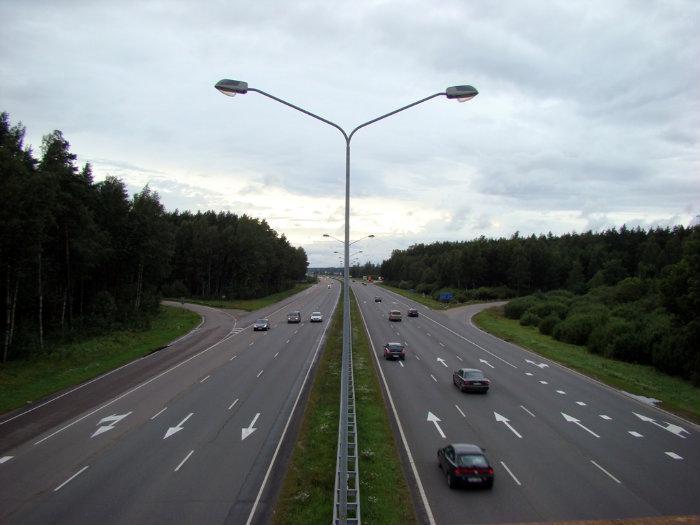
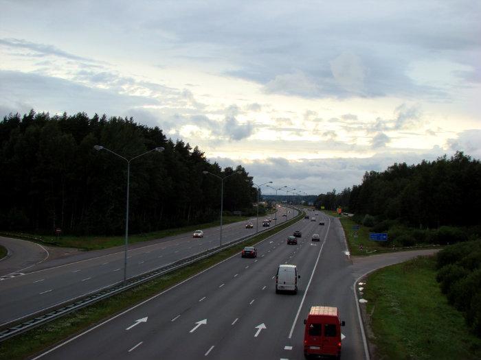


*On photos – view from viaduct/bridge directions to Jurmala, to Riga and to Liepaja, also view under bridge before bridge reconstruction in 2008-2009
Nearby cities:
Coordinates: 56°57'11"N 23°55'29"E
- A118 Ring Road and M11 highway (Tallinskoye shosse) interchange 482 km
- M20 highway (Kiyevskoye shosse) and Volkhonskoye motorroad interchange 485 km
- A118 Ring Road, Western Rapid Diameter, Dachny avenue and Predportovaya street interchange 489 km
- A118 Ring Road and M20 highway (Pulkovskoye shosse) interchange 490 km
- A118 Ring Road and Sofiyskaya street interchange 496 km
- WRS, A118 Ring Road and Konnolakhtinskaya road interchange (UC) 499 km
- Reconstructed traffic intersection "Sokol" of the project "Big Leningradka" 844 km
- Sofrino junction 864 km
- Sergiyev Posad junction 870 km
- Pogranichnaya junction 881 km
- Forest 0.6 km
- Forest 1.5 km
- Forest 1.7 km
- Forest 1.7 km
- Forest 2.2 km
- Slepera bog 2.3 km
- Forest 2.5 km
- Beberbeķi 2.7 km
- Forest 2.8 km
- Babīte parish 8.2 km