Geographic center of Belarus
| interesting place, geodetic point
Belarus /
Minskaja Voblasts /
Marjina Horka /
World
/ Belarus
/ Minskaja Voblasts
/ Marjina Horka
World / Belarus / Minsk
interesting place, geodetic point
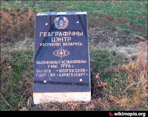
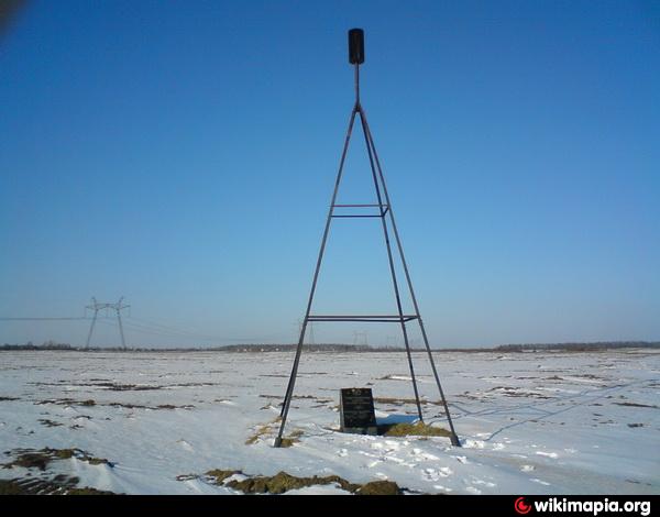
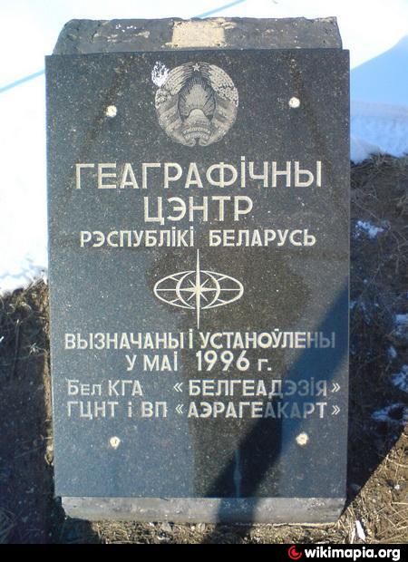

The geographical center of Belarus (Belarusian: Геаграфічны цэнтр Беларусі) is located in the geographical coordinates of latitude 53 ° 31'44, 54 ", longitude 28 ° 02'41, 90". Is 70-km south-east of Minsk, a 6-km west of Marina Hills, and 1 km to the south-east of the village Antonovo, Pukhovisky District, Minsk Oblast.
Wikipedia article: http://en.wikipedia.org/wiki/Geographic_center_of_Belarus
Nearby cities:
Coordinates: 53°31'44"N 28°2'42"E
- Tupischki - Struve Geodetic Arc 156 km
- Lapaty - Struve Geodetic Arc 210 km
- Tchekutsk - Struve Geodetic Arc 223 km
- Liaskowitschi - Struve Geodetic Arc 225 km
- vulica Barykina, 147 232 km
- vulica Kirava, 86 232 km
- Highest point of Bryansk region 355 km
- Geodetic point 374 km
- Felshtyn - Struve Geodetic Arc 477 km
- Brailiv maidan 625 km