Shirley Heights
Antigua and Barbuda /
Saint Paul /
English Harbour /
World
/ Antigua and Barbuda
/ Saint Paul
/ English Harbour
World / Antigua and Barbuda
restaurant, bar, historical building, historic site
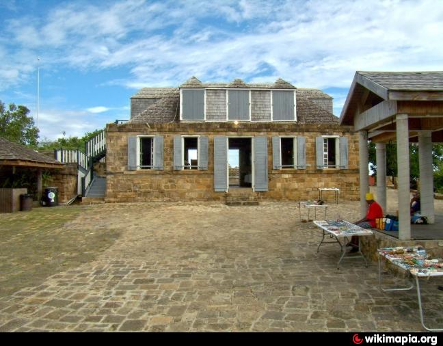
Shirley Heights itself refers to the military complex, along the whole ridge. It is named after Sir Thomas Shirley, Governor of the Leeward Islands, who strengthened Antigua’s defences in 1781. Today there is a restaurant here. Every sunday there ist live-music (steel band and reggae)from 4pm to 10pm, restaurant on site.
Nearby cities:
Coordinates: 17°0'8"N 61°45'16"W
- former borderwall . 4796 km
- former boundary wall 4859 km
- former boundary wall . 4880 km
- former borderwall 4942 km
- former boundary walls . 4942 km
- former boundery wall 4965 km
- former boundary wall 4971 km
- former boundary walls 4974 km
- former borderwalls 5112 km
- Hamaguir former CIEES 6082 km
- English Harbour 1.2 km
- Mamora Bay 2.2 km
- Falmouth Harbour 2.8 km
- Cobbs Cross 2.9 km
- Christian Hill 3.7 km
- Willoughby Bay 4.8 km
- Potsworks Reservoir 6.6 km
- Antigua 10 km
- Guadeloupe Passage 31 km
- Antigua & Barbuda 41 km