Nab Tower Lighthouse
United Kingdom /
England /
East Wittering /
World
/ United Kingdom
/ England
/ East Wittering
tower, lighthouse, First World War 1914-1918
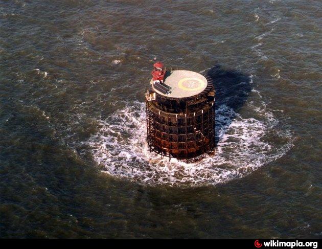
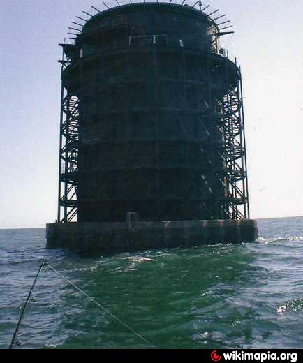
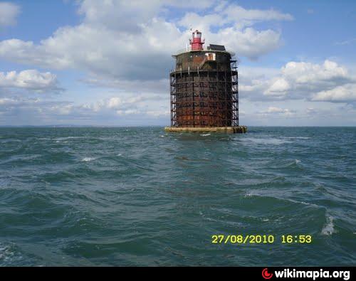
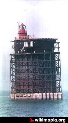
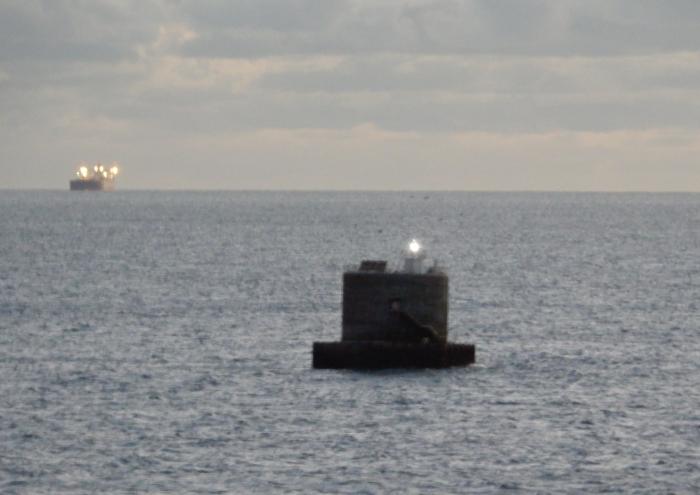
The Nab Tower is a tower planned for anti-submarine protection in the Straits of Dover in World War I. It was sunk over the Nab rocks east of the Isle of Wight to replace a lightship after the war, and is a well known landmark for sailors as it marks the deep water eastern entry into the Solent.
Latitude 50° 40'.05 N Longitude 00° 57'.07 W
Height above mean high water 27 metres.
White flash every 10 seconds - 11,739 Candela Incandescent Electric Filament Lamp.
Fog signal - two blasts every 30 seconds (range 2 nautical miles).
Latitude 50° 40'.05 N Longitude 00° 57'.07 W
Height above mean high water 27 metres.
White flash every 10 seconds - 11,739 Candela Incandescent Electric Filament Lamp.
Fog signal - two blasts every 30 seconds (range 2 nautical miles).
Wikipedia article: http://en.wikipedia.org/wiki/Nab_Tower
Nearby cities:
Coordinates: 50°40'4"N -0°57'9"E
- Horse Sand Fort Light 12 km
- No Mans Land Fort Light 13 km
- Saint Albans Light House 72 km
- Casquets triple Lighthouses 146 km
- Channel Light Vessel Automatic 163 km
- Monkstone Lighthouse 172 km
- Nash Point Lighthouse (east) 199 km
- Eddystone Lighthouse 241 km
- Great Castle Head Lighthouse 313 km
- St. Ann's Head Lighthouse 316 km
- The Cuba (Wreck) 7.7 km
- Wreck of Mary Rose 7.8 km
- Bowling Green 13 km
- Two Tennis Courts 13 km
- Farthings 13 km
- U-1195 13 km
- bunn leisure, west sands 13 km
- St Peters Church 14 km
- Selsey Lifeboat House 14 km
- The Solent 27 km