Pont des Trous (Tournai)
Belgium /
Hennegau /
Tournai
World
/ Belgium
/ Hennegau
/ Tournai
World / Belgium / Wallonie / Hainaut / Tournai
fortification, bridge, listed building / architectural heritage, 13th century construction


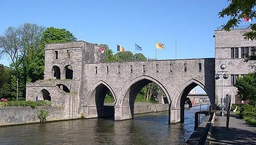
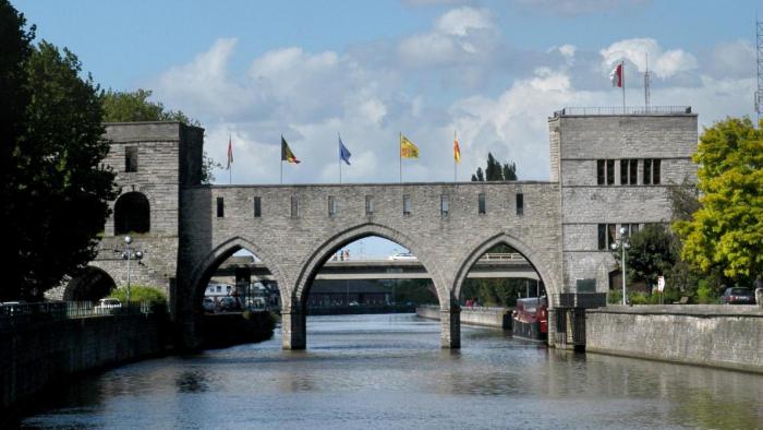


Typical of medieval military architecture, this bridge called 'Pont des Trous' is part of the 13th century city walls. It has two towers which were built in stages between 1281 and 1304. It was the scene of fierce battles especially during the siege of 1340, at the beginning of the 100 Years War.
Nearby cities:
Coordinates: 50°36'46"N 3°23'1"E
- Bridge 1.2 km
- A8 autoroute bridge 2.4 km
- Bridge 27 km
- Bridge 29 km
- Railway bridge-viaduct 29 km
- A16 autoroute bridge 30 km
- road bridge 43 km
- R5 motorway bridge 49 km
- Sart Canal Bridge 55 km
- A15 autoroute bridge 59 km
- Quarters Géneral Baron Rucquoy 2 km
- Tournai (municipality) 2.1 km
- Sagrex - HeidelbergCement Group 5.4 km
- Holcim Belgique 5.9 km
- Sagrex - HeidelbergCement Group 6.4 km
- CCB - Italcementi Group 7.3 km
- Antoing (municipality) 8.6 km
- Rumes (municipality) 9 km
- Brunehaut 9 km
- Péruwelz (municipality) 15 km
Comments