Province Point
USA /
Vermont /
Alburg /
World
/ USA
/ Vermont
/ Alburg
World / United States / Vermont
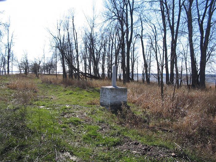
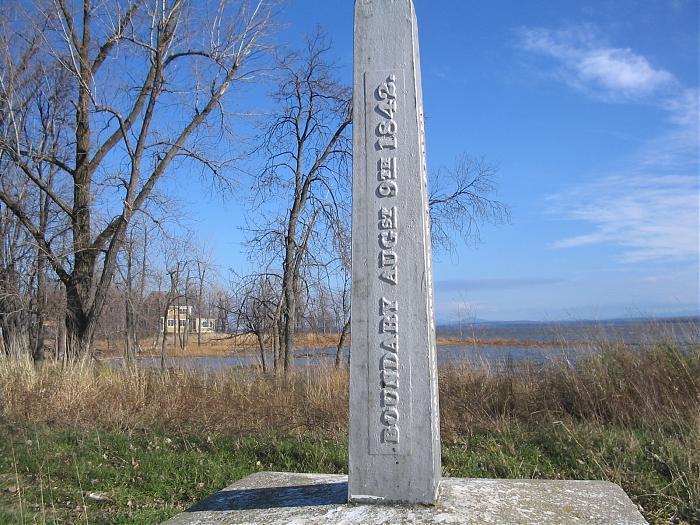
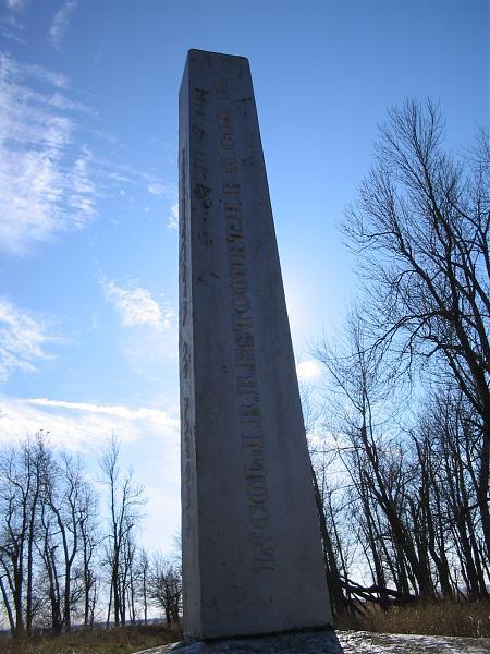
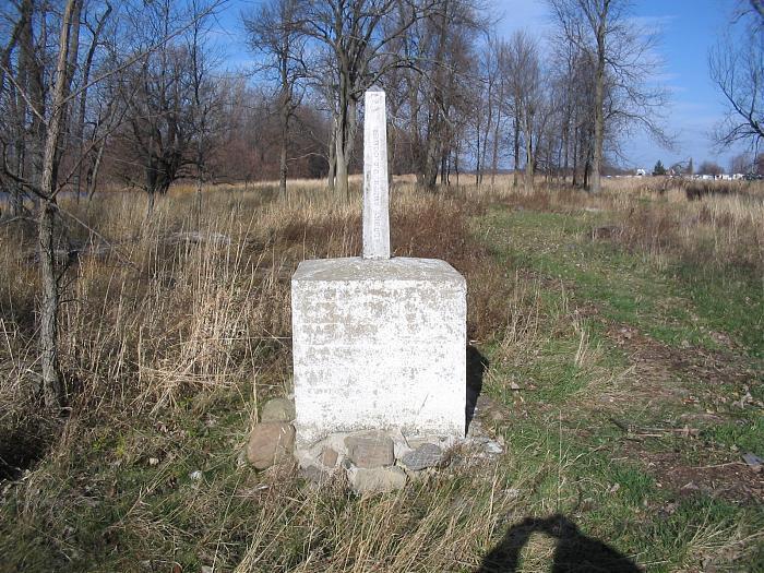
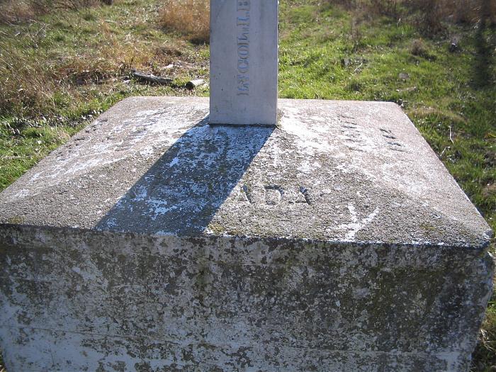

Pointe land welded to Quebec, which juts into Missisquoi Bay of Lake Champlain, east of the bay Chapman, and whose end is included in the American state of Vermont. It is approximately 2 acres in area and a monument marks the location of the border. Its name refers to its partial ownership in the province of Quebec. We find the name "Pointe de la Province" on the map County Missisquoi produced by the Department of Lands and Forests, in 1937. Its official name is "Vermont Province Point."
Wikipedia article: http://en.wikipedia.org/wiki/Lake_Champlain
Nearby cities:
Coordinates: 45°0'46"N 73°11'35"W
- Hog Island 3.5 km
- North Hero 15 km
- Giroux's Poultry Farm 27 km
- Ausable Point 52 km
- The Intervale 56 km
- Shelburne Point 64 km
- Riverview 72 km
- Meacham Lake State Campground 100 km
- Little Long Pond 112 km
- Preston Ponds 121 km
- Missisquoi Bay 3.7 km
- Alburgh, Vermont 12 km
- Swanton, Vermont 13 km
- Swanton, Vermont 13 km
- Highgate, Vermont 14 km
- Town of Champlain, New York 20 km
- North Hero, Vermont 20 km
- Saint Albans Town, Vermont 24 km
- Chazy, New York 26 km
- Lake Champlain 79 km