Sta. Teresa Port
Philippines /
Southern Tagalog /
Santa Teresa /
World
/ Philippines
/ Southern Tagalog
/ Santa Teresa
World / Philippines / Occidental Mindoro / Magsaysay
seaport
Add category
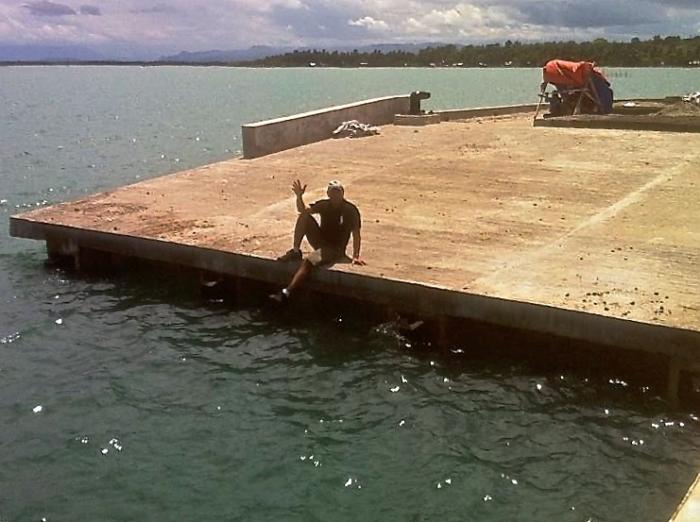
This commercial port was "finished," more or less, according to the locals in 2013. I visited it on Jun 17, 2014. There was no commercial activity and I encountered workers doing something to the pier. The workers are visible crouching under the shade in photo-1.
In photo-1, I am sitting at the ramped section of the pier. In photo-2, I am sitting on a cleat located at the leftmost corner of the pier. Ilin Island is visible in the background in photo-2.
In photo-1, I am sitting at the ramped section of the pier. In photo-2, I am sitting on a cleat located at the leftmost corner of the pier. Ilin Island is visible in the background in photo-2.
Nearby cities:
Coordinates: 12°14'37"N 121°6'37"E
- Laylay Port 154 km
- Port of Batangas, Batangas City 170 km
- Manila South Harbor 262 km
- Manila International Container Terminal 265 km
- Port of Manila North Harbor 265 km
- Manila North Harbour Centre 267 km
- Port of Manila 267 km
- Port of San Jacinto, Masbate Province 287 km
- Sual Power Station 447 km
- Aurora Special Economic Zone Authority 452 km
- Ilin Island 3.5 km
- Sitio Culasiman 5.1 km
- Mount Ilin 6.4 km
- Silong Bay 8.1 km
- Mangarin Bay 8.3 km
- Pandurucan Bay 8.4 km
- Labangan Poblacion 14 km
- AquaPhil Inc. Salt Farm 20 km
- Mindoro Strait 45 km
- Occidental Mindoro 102 km