Gwangju Park (Gwangju)
Korea (South) /
Kwangju /
Gwangju
World
/ Korea (South)
/ Kwangju
/ Kwangju
World / South Korea / Gwangju
park
Add category
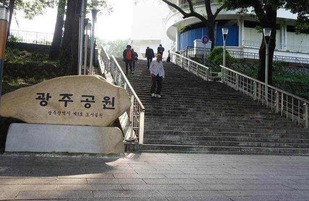
Gwangju Park is the number one park in Gwangju and is visited all year round by citizens and tourists. Once the site of Seonggeosa Temple and a shrine visited by Japanese people during the Japanese Occupation, today Memorial Pavilion, Gwangju Folk Museum, and Citizen Hall stand in their place.
The main facilities include Gwangju Broadcasting Station (KBS), Memorial Tower for Police Officers, Yeongpajeong Pavilion, Gwandeokjeong Pavilion, a traditional Korean archery training center, octagonal pavilion for observing Gwangju's downtown, and the restored Sajikdan Altar. The empty lot surrounding the Memorial Tower is also used as a peaceful resting spot for the city's elderly. Gwangju Park is designed in the shape of a turtle, the symbol of longevity. Filled with lots of trees and flowers, the park boasts beautiful landscaping, especially in mid-April when the cherry blossoms come into full bloom.
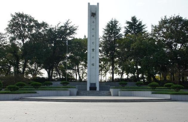
In the May 18 1980 Democratic Uprising, this park became the staging ground for what became known as the Citizens' Army, where weapons were distributed and volunteers were organized into units. The area to the northwest of driveway entering the park, which has buildings on this satellite image, has now been leveled and is the part-park and part-parking area (based on visit in July 2011).
The main facilities include Gwangju Broadcasting Station (KBS), Memorial Tower for Police Officers, Yeongpajeong Pavilion, Gwandeokjeong Pavilion, a traditional Korean archery training center, octagonal pavilion for observing Gwangju's downtown, and the restored Sajikdan Altar. The empty lot surrounding the Memorial Tower is also used as a peaceful resting spot for the city's elderly. Gwangju Park is designed in the shape of a turtle, the symbol of longevity. Filled with lots of trees and flowers, the park boasts beautiful landscaping, especially in mid-April when the cherry blossoms come into full bloom.
In the May 18 1980 Democratic Uprising, this park became the staging ground for what became known as the Citizens' Army, where weapons were distributed and volunteers were organized into units. The area to the northwest of driveway entering the park, which has buildings on this satellite image, has now been leveled and is the part-park and part-parking area (based on visit in July 2011).
Nearby cities:
Coordinates: 35°8'51"N 126°54'32"E
- Baegunsan 55 km
- Jirisan 56 km
- Byeonsanbando National Park 73 km
- Jangansan 80 km
- Minjujisan 131 km
- Songnisan 179 km
- Palgongsan 185 km
- Hallasan 197 km
- Bihaksan (비학산) 234 km
- Juwangsan 247 km
- Yangnim-dong Modern History Culture Village 1 km
- Gwangju World Cup Stadium 3.2 km
- Jeonnam National University 3.3 km
- Geumdangsan 3.9 km
- Kia Motors Gwangju 1 Plant 4 km
- Song-Am Industrial Complex 4.8 km
- Gwangju Sewage Treatment Plant 7.1 km
- Gwangju Airbase/Airport 10 km
- Dogok Hot Springs 13 km
- Pyeong-dong Industrial Complex 13 km