Railway Bridge (Bath)
United Kingdom /
England /
Bath /
Lyncombe Vale Road
World
/ United Kingdom
/ England
/ Bath
World / United Kingdom / England
railway bridge
Add category
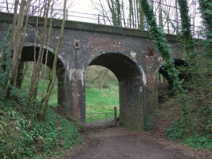
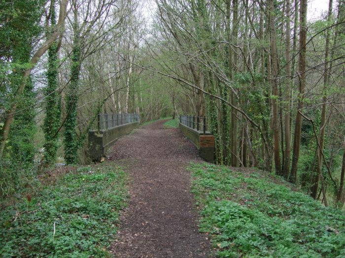
One of the bridges carrying the Somerset and Dorset Line on a section of line between the two tunnels, this will eventually form the line of the two tunnels footpath from the centre of Bath out to Midford and beyond
Nearby cities:
Coordinates: 51°22'9"N 2°21'36"W
- Railway Viaduct 76 km
- Henwick Signalbox 92 km
- Hoobrook Viaduct 112 km
- Fulham Railway Bridge 150 km
- Battersea Railway Bridge 152 km
- Hungerford Bridge 156 km
- Cannon Street Railway Bridge 158 km
- Ouse Valley (or Balcombe) Viaduct 161 km
- Imberhorne Viaduct 165 km
- Thrapston viaduct 169 km
- Beechen Cliff School 0.2 km
- Entry Hill 9 Hole Golf Course 0.9 km
- Foxhill 0.9 km
- Prior Park Gardens 1.1 km
- Odd Down Playing Field 1.3 km
- Prior Park College. 1.3 km
- Beech Wood 1.8 km
- Priory Wood 2.1 km
- Cleeve Rocks 3.1 km
- Somerset 53 km