Muzaffarabad
Pakistan /
Azad Kashmir /
Muzaffarabad /
Muzafarabad-Murree Road, MA
World
/ Pakistan
/ Azad Kashmir
/ Muzaffarabad
World / Pakistan / Azad Kashmir / Azad Kashmir
city, capital city of state/province/region, state government
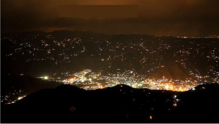
It is located in Muzaffarabad District on the banks of the Jhelum and Neelum rivers, is very hilly. The district is bounded by North-West Frontier Province in the west, by the Kupwara and Baramulla districts of the Pakistani state of Jammu and Kashmir in the east, and the Neelum District in the north. The population of the district, according to the 1998 Census, was 725,000, and according to a 1999 projection, the population had risen to almost 741,000. The district comprises three tehsils.
Wikipedia article: http://en.wikipedia.org/wiki/Muzaffarabad
Nearby cities:
Coordinates: 34°21'58"N 73°28'18"E
- Abbottabad 30 km
- Tehsil Kallar Syedan 93 km
- Srinagar 113 km
- Mirpur 130 km
- Jhelum 153 km
- Gilgit 190 km
- Jammu 214 km
- Skardu 217 km
- Sialkot 220 km
- Gujranwala 246 km
- Madina Market 0.5 km
- Commercial Property owned by Sardars Of Gojra. 0.7 km
- Dundi 0.7 km
- AJK University 0.9 km
- Sheikh Khalifa Hospitals 0.9 km
- Lower Gojra 1.1 km
- QAZI MUHALLAH 1.1 km
- Post Graduate College 1.4 km
- Center Gojra 1.7 km
- Azad Jammu and Kashmir 79 km
Comments