Fukushima II (Daini). Nuclear Power Plant (Naraha, Fukushima)
Japan /
Fukushima /
Namie /
Naraha, Fukushima
World
/ Japan
/ Fukushima
/ Namie
World / Japan / Fukushima
production, radioactive, power station, draw only border, nuclear power plant
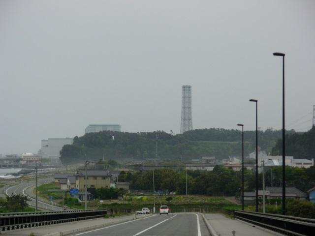
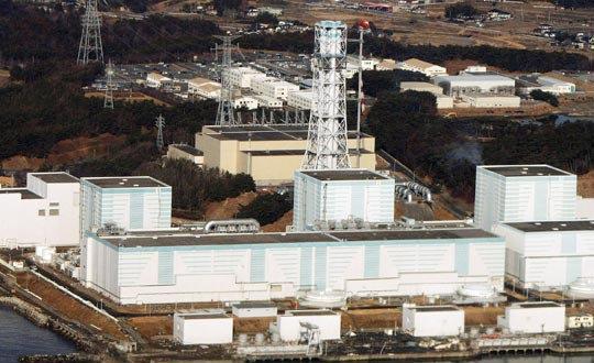
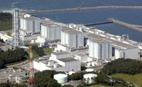
Tokyo Electric Power Company (TEPCO) Fukushima Daini Nuclear Power Station, in the Hamadori area on the Pacific Coast of Fukushima Prefecture, began operation in 1982 and has a total capacity of 4,400 MW. The site covers approximately 155 hectares and has its own private harbor used as the source of sea water to cool the power plant and the dock for shipping out spent fuel and taking in fuel oil.
Wikipedia article: http://en.wikipedia.org/wiki/Fukushima_II_Nuclear_Power_Plant
Nearby cities:
Coordinates: 37°18'58"N 141°1'33"E
- TEPCO Hirono Thermal Power Station 8.6 km
- Fukushima I (Dai-ichi). Nuclear Power Plant 13 km
- Haramati thermal power plant 40 km
- JX Nippon Oil & Energy Corporation Sendai Refinery 108 km
- GREEN FILL KOSAKA (former site of Dowa Kosaka Mine) 338 km
- Eurus Rokkasho Solar Park (Chitosedaira North) 400 km
- Eurus Rokkasho Solar Park (Takahoko) 403 km
- Japan Nuclear Fuel Limited Reprocessing Plant 407 km
- Sojitz Kamikita-Rokkasho Solar Power Plant 407 km
- Rokkasho Wind Farm 407 km
- Radioactive Waste Storage Area 4.5 km
- Radioactive Waste Storage Area 4.6 km
- Radioactive Waste Storage Area 5.3 km
- Yonomori Tsutsumi Park 5.7 km
- J-Village (Japan Football Association's National Training Center) 8.5 km
- agro-Kanesho 9 km
- Okuma General Sports Center 11 km
- Fureai Park Okuma 11 km
- Epicenter of M4.9 quake 15 km
- Fukushima Exclusion Zone (2020) 24 km
Comments