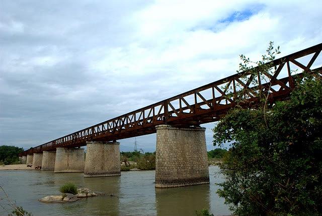
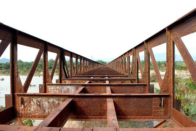
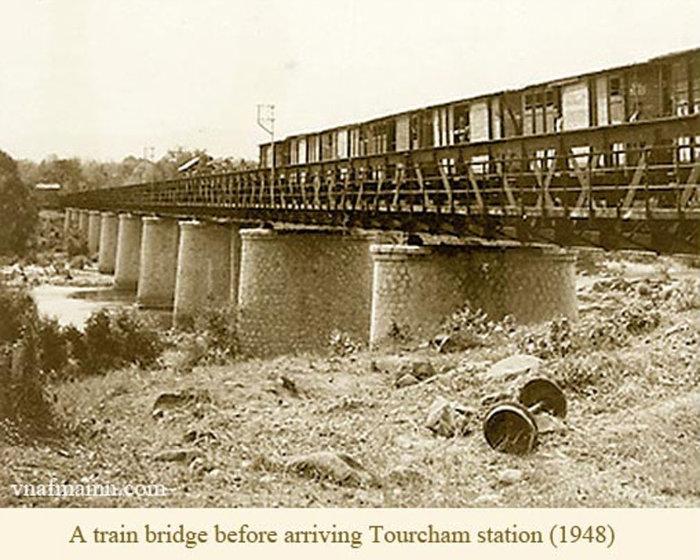
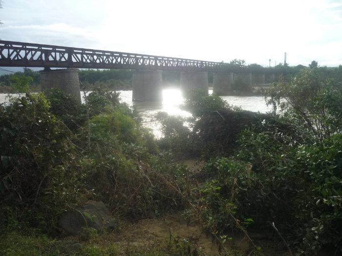
Railway Bridge at Ap Tan My (photos)
Vietnam /
Duyen Hai Mien Trung /
Phan Rang /
World
/ Vietnam
/ Duyen Hai Mien Trung
/ Phan Rang
World / Vietnam / Đông Nam Bộ / Ninh Thuận / Ninh Sơn
railway bridge
Add category
Bridge photos (two of the four) came from here:
ninhchuholiday.com/diendan/showthread.php?t=278
Another photo came from here:
www.daumaytoaxe.com/forum/showthread.php?t=3198
See map here (the website is mine):
www.mekongexpress.com/vietnam/general/maps/TanMyStation...
Text by J. Michener.
ninhchuholiday.com/diendan/showthread.php?t=278
Another photo came from here:
www.daumaytoaxe.com/forum/showthread.php?t=3198
See map here (the website is mine):
www.mekongexpress.com/vietnam/general/maps/TanMyStation...
Text by J. Michener.
Wikipedia article: http://en.wikipedia.org/wiki/Da_Lat–Thap_Cham_Railway
Nearby cities:
Coordinates: 11°42'54"N 108°48'43"E
- Cầu xe lửa 73 km
- cau Duong Sat Bong Son 303 km
- Nam O Bridge 496 km
- Cầu Ga Quảng Trị 587 km
- Cầu Chợ Thượng 835 km
- cau yen xuan cho taon thuan hay ntam do 840 km
- Thai-Lao Friendship Bridge 950 km
- Phú Lương railroad bridge 1060 km
- Long Bien bridge 1086 km
- Duong brigde 1087 km
- Hwy Bridge at Tan My (photo) 0.3 km
- Sunseap Solar Park 2.1 km
- NT-37 11 km
- nha chuc ne 18 km
- Sông Sắt lake 22 km
- Phuoc Thanh commune 26 km