Pumping Station (Marlow)
United Kingdom /
England /
Marlow
World
/ United Kingdom
/ England
/ Marlow
World / United Kingdom / England
pumping station
Add category
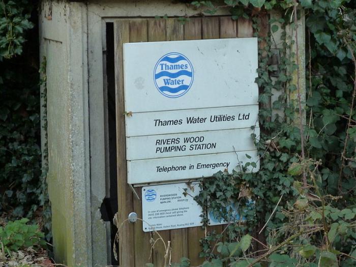
Most of the pumping is underground, only the wooden hut that perhaps contains the tool is visible on the ground level.
Nearby cities:
Coordinates: 51°34'13"N -0°45'35"E
- Southeast Water - Bracknell Covered Reservoir 18 km
- Fobney Water Treatment Works 22 km
- Acton Sewage Storm Tanks 36 km
- Oxford Littlemore Sewage Treatment Works 36 km
- Hogsmill Sewage Treatment Works 37 km
- Bellington Pumping Station 134 km
- Severn Tunnel Pumping Station 135 km
- Shifnal Sewage Works 164 km
- Mill Meece Pumping Station 180 km
- Ryhope Engines Museum 369 km
- Gossmore Recreation Ground 0.4 km
- Old Gravel Pits 0.4 km
- Marlow Rugby Union Football Club 0.5 km
- Riverwoods 0.6 km
- Longridge Water Sports Centre 0.6 km
- Marlow Lock Island 0.7 km
- Foxes Piece Allotment 0.8 km
- Foxes Piece Combined School Grounds 0.9 km
- Gibraltar Island, Marlow 1 km
- Quarry Woods 1.9 km